Republished 23 Feb 2011 -
2,629+ entries.
Last updated:
05 Mar 2021 Village
list & profiles researched,
compiled & published by Jody McKim Pharr, 2008-2011.
Village profiles are periodically updated, so check back. Bibliography
- Sources Used For This Work
Agadici is administered by the town Oraviţa / Orawitz
The history of
Agadici can be traced back to at least the 1600s, when records note a population of 800 souls. Today, there are fewer than 200 people living in Agadici.
Agadici
is a word derived from the Turkish language; Aga meaning 'colonel' and dici meaning 'daughter of.' Therefore, Agadici means, daughter of the colonel. The town was supposedly named after a colonel's daughter when the Ottoman Empire was in occupation of the land that is now the Banat.
Agadici was among 190 villages affected by the deportation to the
Bărăgan Steppe
in 1951.
Familienbuch der katholischen Pfarrgemeinde
Albrechtsflor im Banat 1770 - 1800. Edited by Philipp Lung and HTML Version by Rudy Kirchner, Kanada
[self lookups at banaterheide.de
are no longer available]
Genealogical Records
- Church records
available at LDS - FHC;
Microfilm Nr. :
001 RO - Albrechtsflor:
B. 1783-1848, M.
1783-1899, D. 1783-1862
The
Neumannsche
settlement resulted in
1770 establishing the
following villages:
Kleinjetscha, Heufeld, Mastort, Marienfeld,
Albrechtsflor and
1771 settlements for
Berksowatals: Buchberg,
Neuhof, Altringen,
Charlottenburg,
Königshof, Blumenthal
and the villages of the
Arader Land Segenthau,
Wiesenhaid, Kreuzstätten
and the French villages
Sankt-Hubert, Seultour
und Charleville.
(Source: Quellennachweis:
Donauschwäbische
Geschichte. Das
Jahrhundert der
Ansiedlung 1689-1805 von
Oskar Feldtänzer) [Note:
Von Neumann,
official with the
Transylvanian Salt Depot
in Lippa]
Lookups Guide:
Nick Tullius -
Heimatbuch 1987 (including original 1933 Heimatbuch); Heimatbuch 1998 (2 volumes: one text; one photographs); Familienbuch (Ortssippenbuch) 2001 (1833 to 2000).
Familienbuch der
katholischen
Pfarrgemeinde
Alexanderhausen im Banat
1833-2000 by Helene
Schuch. [self lookups
at banaterheide.de are no longer available]
Genealogical Records - Church records available at LDS - FHC; Microfilm Nr.: 002 RO -
Alexanderhausen B. 1833-1846 M. 1833-1852 D. 1833-1852.
Alexanderhausen Village Chairman / H.O.G.: Stefan Herwig
Aliosch Village
Chairman /
H.O.G.:
Josef
Scheirich.
The Last
of the
German
Village of
Aliosch by
Anton
Zollner,
1997
(German,
-would
appreciate
an English
translation
to publish)
Portion: Aliosch
(officially:
Alios,
Hungarian:
Temesillésd)
is a stern
of Banat
village,
which lies
on the road
Timişoara -
Lippa north
of
Blumenthal.
Administratively
part of this
village with
a mixed
population
to the
community
Blumenthal
(also called
Maschlok).
In 1910, 315
Germans were
17 percent
of Aliosch's
population.
After World
War II the
German
population
declined. Since
1944, the
number of
Germans fell
steadily
until today.
In the
census of
January
1992, here
only 23
Germans
remaining
and the rest
of the
population
consisted of
913
Romanians,
11
Hungarians
and 13
Other.
Catholic
Church Name:
Unknown.
Branch of:
Guttenbrunn.
Rumanian
Marul
was
changed to
Almafa "apple-tree" Anuarul "Socec" al
Romaniei-mari.
Zăvoi (Hungarian: Závoly)
is a commune in Caraș-Severin County,
western Romania with a population of 4,343 people. It is situated in the historical region of Banat.
It is composed of seven villages: 23 August,
Măgura
(Korcsoma),
Mogura: Măgura Ilvei (Magura)
Măru (Almafa),
(Almafatelep),
Poiana Mărului,
Romania | Hungarian:Almásmező
| Deutsch: Bleschenbach Valea Bistrei,
Romania = (Hungarian:Bisztranagyvölgy)
| Voislova,
Romania = (Hungarian: Szörénybalázsd
| Deutsch: Woislowa Zăvoi,
Romania = (Hungarian: Závoly)
Situated in the Gurahont Basin, in the left valley of the Crisul Alb River, the commune Almas consists of four
villages: Almas - the commune centre situated at 97 km far from Arad, Cil, Rădesti, Joia Mare.
Situated in the
Gurahonț Basin, in the
left valley of the
Crişul Alb River, the
commune is composed of
four villages: Almaș
(situated at 97 km from
Arad), Cil (Alcsil),
Joia Mare (Kakaró)
and Rădești (Bozósd).
Its total administrative
territory is 8127 ha.
There is a monastery
dedicated to the
Annunciation, and the
Rădeștilor Valley.
There are three
villages in Dudeştii
Vechi: Cheglevici, Colonia Bulgară
and Dudeştii
Vechi. Dudeştii
Vechi is mostly
populated by Banat
Bulgarians (Palćene),
a regional minority
group of ethnic
Bulgarians that
profess Roman
Catholicism, who
came from northern
Bulgaria, and who
are descendants of Paulicians that
settled in the area
around 1738.
Altbeschenowa was among
190 villages deported to the
Bărăgan Steppe
in 1951.
Borča is located just 8
kilometers north of the
downtown Belgrade, in
the Banat section of the
municipality of Palilula.
As one of the
largest suburbs
of Belgrade and
a large
settlement in
its own right,
Borča developed
several
sub-neighborhoods
of its own.
Officially,
Borča is divided
into three
"local
communities" (mesna
zajednica),
sub-municipal
administrative
units: Stara
Borča (foremerly
Borča I), Borča
Greda (formerly
Borča II) and
Nova Borča
(formerly Borča
III). Most of
Borča is grouped
into centers (Centar
I to V), which
are sometimes
referred to as
Borča I to V (Centar
I = Borča I,
etc).
Genealogical Records - Church records available at LDS - FHC;
Microfilm Nr. : 021 YU - Deutsch-Etschka: B. 1793-1831, M. 1793-1851, D. 1794-1835.
1773-1944 Rudolfsgnad im Banat von
Philipp Lung.
Familienbuch
der
Gemeinden
Deutsch-Etschka,
Sigmundfeld,
Rudolfsgnad
im Banat by Philipp
Lung; mit einer
Geschichte
der
Besiedlung
by Reiner
Schlotthauer.
Published 1999
by P. Lung
in
Villingen-Schwenningen.
Written in
German.
Photo: Etschka, jugosl.
Banat: Schwabische
Frauen in der "Spinnstube."
In 1838, the village was
populated by Banat
Bulgarians, and, in 1839 its
population numbered 426
inhabitants. During 19th
century, Hungarians,
Germans, and Slovaks settled
in the village as well.
After World War I, the new
Serb settlers came to the
village. In 1921, the
population of the village
numbered 1,011 inhabitants,
including 426 Hungarians,
290 Germans, 138 Serbs, 29
Slovaks, and 97 other Slavs.
After World War II, as a
consequence of the war
events, the German
population fled from the
village and it was then
populated by new Serb and
Macedonian settlers.
Located
in the Bela Crkva municipality,
South Banat District of Vojvodina.
MAP DESCRIPTION:
The
excellent
coloured
engraving
shows
the city
of
Palanka
in
Hungaria. Banatska
Palanka
is a
village
in
Serbia.
It is
situated
in the
Bela
Crkva
municipality,
South
Banat
District,
Vojvodina
province. On
the back
you can
find a
latin
description. This
wonderful
view was
published
in the
Janssonius
town
books in
1650. The
town
books
contain
views of
cities
and
towns
from all
over the
world
and were
published
at a
time
when
Joannes
and
Cornelis
Blaeu
were
still
planning
their
"cities
of the
world".
But
contrary
to what
the
Blaeus
had
produced and
were to
produce,
Janssonius's
work was
not
original
throughout. Janssonius
had
acquired
the
plates
of the
Civitates
orbis
terrarum
from
Abraham
Hogenberg.
The bulk
was
incorporated
into the
townbooks.
For many
plates
of the
cities
of the
Netherland,
Janssonius
ordered
copper
plates,
newly
engraved
after
the
orininals
by
Blaeu.
Further
artists
are only
partly
known.
Size of
map
appr:
32,5 x
44,5
cm, Size
of leaf
appr:
49,5 x
59,5 cm.
Large decorative colored copper
engraving view of "Palanka
superioris Hungariae civitas." after
Georg Hoefnagel, Amsterdam, um 1650
A.D. aus "Theatrum Praecipuarum
Urbium" [Janssonius Städtebuch]
CARTOGRAPHER: Johann
Janssonius, a dutch
cartographer and publisher
(*1588; † 1664; aka Jan
Jansson).
Image & Information
contributed by:
Patrick Oehme,
Antiqua Global Art
Leipzig, Germany
info@antiqua-global-art.com
[Published at DVHH.org 28
Dec 2007 by Jody McKim
Pharr]
In ancient times it was a Dacian fortress called Ziridava and today it is an
important archeological site. Situated 25 kilometres (16 mi) from Arad, the town Pecica is a
new urban settlement. The administrative territory of the town extends in the Aradului
Plateau, it adheres three rural settlements: Bodrogu Vechi, Sederhat and Turnu.
Catholic Church name:
Unknown, Branch of
Ungarisch-Petschka.*
Between 1770 - 1771 the old
village was subject to
colonization by German General
Johann Altringen, a period in
which the entire Banat is
subject to colonization by
Germans. General Altringen,
acting governor of the Banat,
ordered the establishment of
several villages for German
settlers in this area. These
Charlottenburg (named after his
wife) and Altringen. To make
room for German settlers, the
native population was relocated
to other villages. Altringen
Romanians continued to use the
name or Recheşel Recăşel until
the interwar period.
The
Neumannsche
settlement resulted in
1770 establishing the
following villages:
Kleinjetscha, Heufeld,
Mastort, Marienfeld,
Albrechtsflor und 1771
zur Besiedlung des
Berksowatals: Buchberg,
Neuhof,
Altringen,
Charlottenburg,
Königshof, Blumenthal
and the villages of the
Arader Land Segenthau,
Wiesenhaid, Kreuzstätten
and the French villages
Sankt-Hubert, Seultour
und Charleville.
(Source: Quellennachweis:
Donauschwäbische
Geschichte. Das
Jahrhundert der
Ansiedlung 1689-1805 von
Oskar Feldtänzer) [Note:
Von Neumann,
official with the
Transylvanian Salt Depot
in Lippa].
In 1910 the Germans accounted
for 88% of the population of
Altringen. After the Second
World War their number decreases
rapidly. By 1992 the Germans had
migrated completely. Romanian
people are the majority today,
most of whom emigrated from
other parts of Romania.
Today the village is
predominantly a holiday village
in the city. Recently opened
hostel arranged here and a
Swabian style.
The commune is
situated in the
Crișurilor
Plateau and is
composed of
three villages:
Apateu
(situated at
77 km from
Arad), Berechiu (Alsóbarakony)
and Moțiori.
The nearest city
is Ineu at
35 km.
"Gheorghe
Popovici"
Secondary School
of Apateu is situated in
Arad district,
in Apateu. The
students come
from the three
villages that
compose the
commune: Apateu,
Berechiu and
Moţiori. The
secondary level
is only at the
School of Apateu,
while the
students from
Berechiu and
Moţiori are
brought to
Apateu by the
school bus. The
headmaster of
the school is
Vlad Claudiu
Daniel. The
Comenius team is
formed of Botas
Alina, Borca
Viorica, Dema
Ancuţa, Vlad
Lenuţa, Dema
Daniel and Vlad
Claudiu Daniel. www.comenius-apateu.ro
Lookups
Guide:
Eve
Brown
-
Ortssippenbuch
from
Apfeldorf,
Banat
1767-1835/1851/1868,
by
Michael
Adelhardt
and
Elfriede
Adelhardt,
geb.
Kern -
published
in 2004
these
are
Cath. or
Orthodox
records.
Genealogical
Records
-
Church
records
available
at LDS -
FHC;
Microfilm
Nr. :
004
YU -
Apfeldorf:
B.
1766-1835,
M.
1766-1868,
D
1767-1851.
The
village
currently
has a
Serb
ethnic
majority
and its
population
was
6,312 in
the 2002
census.
Name
Jabuka
means
"apple"
in
Serbian.
The
Hungarian
and
German
names
for the
village
have
same
meaning.
In
Hungarian,
the
village
was
known as
Torontálalmás
(Alma
means
"apple"
in
Hungarian)
and in
German
as
Apfeldorf
("Apple
village").
The
German
population
called
the
village
Jabuka,
named
after a
former
destroyed
village
founded
by
Slavic
fishermen;
it was
named
Apfeldorf
when the
German
army
occupied
the area
in World
War II.
Ortssippenbuch
Jabuka (Apfeldorf)
Banat
1767-1835/1851/1868
by
Michael
Adelhardt
&
Elfriede
Adelhardt,
geb.
Kern.
Published
2004
these
are
Cath. or
Orthodox
records.
10 April 1913 – Arad
- Podgoria, the
first electrical
railway in Eastern
Europe and the
eighth in the world
was built in Arad.
Aradu vechiu
(Source: Stanescu,
Emer. Basil. Buchetu
de semtieminte
natiunale peanulu
1860. in. 8-r. 35 1.
es 1 lev.) Aradu
vechiu, 1860. Lui
Enricu Goldscheider.
—.40 M. Magyarország
bibliographiája,
1712-1860.
Sânmartin (Arad-Sankt-Martin)
and the village of
Macea (Hungarian: Mácsa; German: Matscha) .
make up one commune. It is located 23 km from Arad and 6 km from Curtici.
The natural
reservation called "Arboretul de la Macea" (20,5 ha), the Macea castle - architectural monument
belonging to the national patrimony, built in the 19th century, the exhibition room with
caricatures, well as the beach and the botanical garden are the most attractive places of the
commune.
Genealogical Records
- Church records
available at LDS -
007 RO -
Arad St.
Martin: B.
1750-1852, M.
1750-1852, D. 1750-1852.
Catholic
Church Name:H l. Martin,
Branch of
Elek*
(In the years
1742-1750,
the faithful
Catholics
cared for
the parish
of
Aradsanktmartin.
The small
church was a
wooden
building.)
Răuţi
(Aurelheim)
is part of a
four village commune
with
Uivar
(Uiwar/Neuburg an der
Bega), Pustiniş, & Sânmartinu Maghiar.
Located
in the western
south-west of Timis
county, on the right
bank of the Bega Canal,
about 25 km west of the
city of Timisoara, South
of Hatzfeld.
DVHH Lookup
Guide: Remich Dubas, Helen
- Familienbuch
der katholischen
Pfarrgemeinde
Neuburg an der Bega
(=Ujvar,Uiwar) im
Banat und deutschen
familien in
Aurelheim (=Aurelhaz,
Rauti) by Josef
Kuhn.
Belinț
(Hungarian:
Belence)
is a commune in
Timiș County,
Romania, in the
Banat region. It
is located
between the
cities of
Timișoara and
Lugoj, and is
composed of four
villages: Babșa
(Babsa),
Belinț, Chizătău
(Kiszető)
and Gruni (Grúny).
Ortssippenbuch
Banat-Brestowatz -
Rustendorf;
Ploschitz -
Blauschütz
1766-1835, 1870-2000
/
Adelhardt, Michael; Adelhardt, Elfriede,
2005; 388 pages. Order from: Michael und Elfriede Adelhardt, Veilchenstr. 18, 76131 Karlsruhe
Genealogical
Records:
Village name at FHL:
Bresztovác/Banatski
Brestovác; microfilm no.
0858408 Catholic
Records: B.
1766-1835, M. 1766-1835, D.
1766-1835.
Location of a prisoner
camp for Germans held by
partisans during World War
II.
In the year of
1717 Banatski
Brestovac is
mentioned for first
time in an Latin
document under name Praestowatz.
In the year 1763, there
were 130 German families and
104 Serb families who
existed in village together.
In 1766 Catholic Church is
erected (in 1945 it was
demolished by communists). In that time, the
population of the village
numbered 12 families. In the
year 1763, 130 German
families are settled and
also 104 Serb families
existed in village in that
time. The Serbs had their
Orthodox Church
& mill.
German Population:
1910
63.4%
1921
69.5%
1935
2,478
1991
n/a
2002
n/a
In 1766
a Catholic
Church
was erected (in
1945 it was
demolished
by
communists). Today in its location
is a community center.
A
village in the Kikinda
municipality, in the
North Banat District of
the Republic of Serbia.
It is situated in the
Autonomous Province of
Vojvodina. The village
has a population of
1,066 of which 570
(53.47%) are ethnic
Serbs and 434 (40.71%)
are ethnic Hungarians.
The location of the
village is 18 kilometers
south of the city of
Kikinda.
Administratively, the
settlement named Vincaid is also
classified as part of Banatska
Topola.
Catholic
Church
Church name: The
Ascension of
Blessed
Virgin Mary*
New German Book:
"Banatska Topola
1945:
Vertreibungsvorgang,
nebst Quellentips
für Ahnenforschung"
- Click scroll for
more information.
Banat-Topola Schwaben: 1791-1945 by Jacob
Steigerwald, 1992
Finding
Vital
1796-1945
Data
Regarding
German
and
Hungarian
Ancestors
of
Banat(ska)
Topola
and
Novo
Selo,
Plus
an
Exposé
About
the
Local
1945-1946
Internment
Camp
for
Germans
of
Yugoslavia;
By
Jacob
Steigerwald,
Ph.
D.
(Littleton,
CO,
2009).
ISBN
0-9615505-5-4.
As of 1945, the following family
names were represented at
Banatska Topola = Torontáltopolya = Töröktopolya
and neighboring Novo Selo.
(Quite a few German and some
French-speaking early settlers came from Banat area villages
like Heufeld, Mastort,
St. Hubert,
Charleville, and
Soltur):
Bauer, Beck, Behring,
Bogner, Brenner, Dippong
(DuPont), Eck, Ermler, Erndt,
Escher, Fetter, Fillip
(Phillip), Fuchs, Gantschier,
Geisler, Gengler, Grün,
Haberland, Huhn, Jäger,
Jakob, Keller, Kittl,
Klecker, Konrad, Kowatsch,
Kubi, Lang, Leblang
(LeBlanc), Lesch, Loch,
Lohberger, Loran, Lutje (Luthier),
Lutsch, Martin, Massong (Maçon).
Mayer, Müller, Nimmersein,
Paul, Peckl, Petri, Potwen,
Pressler, Renji (Renier),
Schödl, Schummer, Schwarz,
Sendef, Simon, Springer,
Steigerwald, Steinmetz,
Walter, Wasza, Willar.
Last Names of local Hungarian
residents included the
following:Ács, Alár, Bába, Bálint,
Balogh, Barna, Benyocki,
Bodri, Bögre, Boros, Borsi,
Borzsos, Cil(l)I, Cukrász,
Dudás, Farkas, Fazékas,
Fehér, Fejes, Galsik, Gyönge,
Hegedüs, Horváth, Huszár,
Kanász, Kardos, Kiss, Kocsis,
Kurunci, Lakatos, Lengyel,
Matyus, Mészáros, Molnár,
Nagy, Németh, Ökrös, Rónay,
Szabó, Szakál, Szánto, Szöke,
Takács, Tamasi, Toth, Turi,
Vajda, Varga, Veréb, Vörös,
Zónai.
FOR LEADS TO RECORDS,
CONSULT:
Finding Vital 1796-1945 Data
Regarding German and Hungarian
Ancestors of Banat(ska) Topola
and Novo Selo, Plus an Exposé
About the Local 1945-1946
Internment Camp for Germans of
Yugoslavia. By Jacob Steigerwald, Ph. D.
(Littleton, Colorado, 2009).
ISBN 0-9615505-5-4.
USES OF THIS BOOKLET
INCLUDE:
a) Locating vital
data relating to
German and Hungarian
ancestors that lived
at Novo Selo and/or
Torontaltoplya =
Töröktopolya = Banat
Topola = Banatska
Topola between 1796
and 1945,
b) Finding
references to area
villages where
ancestors used to
live before they
relocated to the
places indicated,
c) Discerning
population growth
and developmental
stages of Novo Selo,
Torontaltoplya =Töröktopolya
= Banat Topola =
Banatska Topola;
d) References to
further sources of
information are
provided in the
Bibliography,
e) Gaining insights
concerning the
unlawful internment
tribulation of
indigenous Germans
when Marshall Tito
and communist
partisans came to
power near the end
of WWII,
f) Learning about
evil procedures
employed for
eliminating former
Yugoslavia's German
minority, despite
the fact that group
members' local
presence extended
back to the 18th
century.
g) Getting a better
understanding about
the ethnic minority
known as
Donauschwaben, i.
e., Danube Swabians,
and their primary
habitats in Hungary,
Romania, and former
Yugoslavia.
h) Indications
regarding current
whereabouts of the
widely dispersed
group members in
different countries
are found in the
Preface. - An Index
provided guides
readers to topics
touched upon.
Copies of the opus can be
ordered for $3.99 each, plus $2.00 shipping (in the U.S.A.), from: Translation &
Interpretation Svc. 5960 S. Estes Street, Littleton, Colorado 80123 U.S.A.
"Banatska Topola 1945: Vertreibungsvorgang, nebst Quellentips für Ahnenforschung"
[BT 1945: Expulsion process, with source tips for ancestral research] by Jacob Steigerwald, Ph. D.
Copies can be ordered for $4.99 each, plus $2.00 shipping (in
the U.S.A.), from: Translation & Interpretation Svc 5960 S. Estes Street
Littleton, Colorado 80123 U.S.A.
ISBN: O-961550505-6-2
Banat Topolas Schwaben: 1791-1945.
by Jacob Steigerwald, Ph. D.,
Winona, Minnesota:
Translation &
Interpretation Service, 1992. ISBN
0-9615505-3-8
Descendants of
expelled and
widely scattered
former
inhabitants of
this village in
the Vojvodina
are now also
living in some
English-speaking
countries.
The listing of
former local
residents
(p.48-51) should
prove useful in
genealogical
research, along
with the village
history that is
provided, from
it's founding to
the expulsion of
its
German-speaking
native
population in
1945. - How this
German-Hungarian
Catholic
settlement with
the successive
names of
Torontáltopolya,
Töröktopolya,
and Banatska
Topola became a
place of
religious
veneration is
also covered in
this combined
German and
English volume. [Reviews]
Bilingual
paperback (Ger.
& Engl.) 27.5 X
21 cm, 154
pages, $19.95,
ISBN
0-9615505-3-9
Illus., with
intermittent
biographic
content and a
bibliography.
(Winona, MN
1992).
Availability status: In stock Order
through bookstores or by mail from: T & I Svc, 5960 S. Estes St., Littleton, CO 80123
The village was founded in 1765. It was settled by German settlers, but also by
Serbs and Romanians. Before the foundation of the village, two older settlement known as
Zeldoš and Velika Dolina existed at this location; populated by Serbs and Romanians. In
1767, 43 Romanian families from Pančevo were settled in Novo Selo. In 1918, about 80
percent of the population of the village were ethnic Romanians. [citation needed] Until
1959, Banatsko Novo Selo had a status of separate municipality.
More recently, on the April 5, 1999, during the NATO Bombing Campaign of the Kosovo
War there were unsubstantiated claims of Yugoslavian forces, led by Lt.Col. Zoran
Damnjanović's air defense unit shot down up to two NATO aircraft between Banatsko Novo
Selo and the neighboring village of Dolovo.
Banatsko Veliko Selo, Yugoslavia (Official)
"name means "the big village
in Banat"
A village in
the
Kikinda
municipality,
in the North
Banat
District of
the Republic
of Serbia.
It is
situated in
the
Autonomous
Province of
Vojvodina.
Following Ottoman rule, there
were no proper settlements in
the present location of the
village. Following an order by
the Empress Maria Theresa of
Austria on November 25, 1763,
the right to settle this area
was given exclusively to Roman
Catholics. In 1770 and 1771,
this area was settled by French
settlers from the Lorraine
region and by southwestern
German settlers, the
southwestern German settlers
later becoming known as the
Banat Swabians. They founded
three villages—Sankt Hubert,
Charleville and Seultour. In
the course of the late 18th
century, these settlements
changed hands several times.
Over time, the French settlers
were assimilated into the German
population. After World War II,
the Germans fled to Germany and
Serb families from Bosnia came
to the settlements.
One
larger village named Veliko Selo
was formed out of the three
existing German villages.In 1948, its name was changed to
Banatsko Veliko Selo. The
names of the former German
villages are today used as names
for districts within the larger
village.
Seultour,
St. Hubert, Charleville: Familienbuch der Katholischen Pfarragemeinde (ohne
Heufeld and Mastort) in Banat, 1770-1835/1854 von Josef Kuhn.
Lookups Guide:
Tom Schneider -
Ortsippenbuch (Banatsko Veliko Selo)
by Nikolaus Hess was published in 1927.
Book
contains list of early settlers & towns of origin. Note:There was a second book that carried
the history through to post WWII times by Michael Gross published in
1981. It actually contains the entire book by Hess within it.
Lookups Guide:William
Knuttel
- St.
Hubert,
Charleville,
Seultour
Lookups:
Familienbuch
der
katholischen
Pfarrgemeinde
im Banat St.
Hubert,
Charleville
und Soltur
1770-1835/1854
von Josef
Kuhn. Kirchenbuch,
1771-1854.
(LDS
microfilmed
church
records: FHL
INTL films
858403,
858404) CDs of
church
records
(Births:
1772-1835,
1854-1869,
1895-1930;
Marriages:
1771-1854,
1895-1905;
Deaths:
1771-1870)
Articles of interest
to Banaters, and all
those who have roots
from the Lorrain
area.
A focus on
Saint-Hubert,
Charleville and Seultour. [12 Oct
2010], Translated
into English.
Bârsa is a commune in
Arad County,
situated in the Sebiș Basin, on
the left part of
the Mills Ditch
and it has an
administrative
territory of
5174 ha. It is
composed of four
villages: Aldești (Áldófalva),
Bârsa
(situated at
77 km from
Arad), Hodiș
(Zarándhódos)
and Voivodeni
(Körösvajda).
Basosch (German) Bassosch
(German) Bazoşu Nou
(German) Neu Basosch
(German) Új Bázos (Hungarian) Bázos, Bázós
(Hungarian) Bazoşu
Vechi
(Other) Bazoş,
Romania
(Official)
Bazoş (German Basosch,
Hungarian Bázos) is
first dated on Mercy’s
map (1723-1725) as Basos.
In 1783 it appeared as
Bassosch (Suciu, DILT,
I, p. 59), while the
Hungarian administration
names were Bazuss (Nagy,
I, p. 374) and Bázos
(1851 and 1913).
Korabinski said that
Basos or Bazos is a
valah settlement where
population breeds
cattle, raise bees and
make wheels for charriot.
In the middle 19th
century about 40
Hungarian families were
colonized here. Bazoşu
Nou (German Neu Basosch,
Hungarian Új Bázos) was
built in 1854 (Suciu,
DILT, I, p. 59) and was
a Romanian village. It
grew in importance after
the natural park was
created. [Remus Cretan]
Official map drawn in 1761
shows the village as an
uninhabited area. In 1783 it
appears with the name
Bassosch (German).
The property has long been erariului.
From 1867 the property
passed erariu Ambrozy
brothers (or Ambrose).
Throughout the nineteenth
century, the Hungarian
government settled 30
Hungarian families.
Between 1909 and 1914 Louis
arranged for the Ambrozy
family estate who owned a
populated forest with dozens
of botanical species from
the North American
continent, especially from
the Arboretum at Harvard
University. Thus was born Bazoş Dendrologic Park.
In
1926, the western boundary
of the village, which
belonged to the estate of
Louis Ambrozy were brought
about 46 families around
Sibiu Transylvania and
founded a new settlement was
named New Bazoşu.
Commune
Bata
lies
in the contact zone of the Lipovei Plateau and the large deep valley of the River Mures,
respectively in the Brănisca-Păulis Couloir. Commune
consist of 4 villages:
Bata, Bacăul de Mijloc (Hungarian: Bakamező),
Bulci (Hungarian: Bulcs)
& Ţela.
Belinţ (German Bellinz,
Hung. Belintz) was first
mentioned in 1285 as "possesionea Becl", while in 1368
Belenche belonged to
Beshan family (Ilieşiu,
Doc., dos. III, p. 112).
In 1482 was first mentioned
a similar form as today,
Belincz (Suciu, DILT, I,
p. 69). The defters (Turkish
documents) presented two
settlements Lower Belicz
(Belinţul de Jos) and Upper Belincz (Belinţul
de Sus), both belonging
to Horasty (Horescu)
family. In 2002 Belinţ had 2,842
inhabitants - 80%
Romanians, 15%
Hungarians etc.*
A village on the banks of the Mures in Hunedoara County, Transylvania, RO.
Benzenz, Romanian
Aurel Vlaicu, Hungarian
Bencenc, located in the district of Hunedoara in Transylvania, Romania, about 23 km as the crow west of Muhlbach.The geographical coordinates are 45 ° 54 'north latitude and 23 ° 16' east longitude.
Resettled by
Batschka
Germans
around
1900.
Birthplace
of Romanian
pilot,
AurelVlaicu (b. Nov 19, 1882 – d. Sep 13, 1913) was a
Romanian engineer, inventor, airplane constructor and early pilot. Aurel Vlaicu was
born in Binţinţi (now renamed Aurel Vlaicu) Geoagiu, Transylvania.
http://en.wikipedia.org/wiki/Aurel_Vlaicu
Berliște
is a
commune in
Caraș-Severin
County, western
Romania with a
population of
1,358 people. It
is composed of
five villages:
Berliște, Iam,
Milcoveni,
Rusova Nouă and
Rusova Veche.
Berzasca
(Hungarian: Berszászka,
Berzászka, German: Bersaska,
Serbian: Berzaska) is a commune in
Caraş-Severin County,
western Romania (Banat) with
a population of 3,123 people
which includes Berzasca,
Bigăr, Cozla, Drencova and
Liubcova villages. At the
2002 census, 70.5% of the
commune's inhabitants were
Romanians, 14.2% Czechs,
10.8% Serbs and 3.5% Roma.
82.8% were Romanian Orthodox
and 15.6% Roman Catholic.
Berg Saska (Deutsch:
Das Banat in:
Josephinische
Landesaufnahme,
1769-72)
Perschaschka (Geographisch-historisches
und Produkten Lexikon von
Ungarn By Johann Matthias
Korabinsky, Published by
Weber & Korabinsky 1786~ pg
523)
Bârzava (Hungarian: Berzova) is a commune in Arad County, Romania. The commune Bârzava is situated at the foot of Zărand Mountains, at its contact point with Metaliferi Mountains, along the Bârzava River - the right branch of the Mureș River.
It is composed of eight villages: Bârzava (situated at 61 km from Arad), Bătuța (Battuca), Căpruța (Kapruca), Dumbrăvița (Alsódombró), Groșii Noi (Garassa), Lalașinț (Lalánc), Monoroștia (Marosmonyoró) and Slatina de Mureș (Marosszlatina).
"Biserica de lemn din Groşii Noi" (Wooden Church in Groşii Noi "Candlemas") - a historical Romanian Orthodox church and architectural monument dated from the year 1807, "Biserica de lemn din Groşii Noi"
Bethausen
was founded in
1883, when German
settlers Zichandorf
settled on this
territory. The village is
situated in the
eastern county of
Timis, the right
bank of the Bega
River, 26 km from
the city of Lugoj.
Genealogical Records
- Church records
available at LDS - FHC;
Microfilm Nr. :
009 RO -
Billed: B. 1766-1811, M.
1766-1836, D. 1766-1809
Familienbuchder
katholischen
Pfarrgemeinde
Billed
Band I
Register
(702 pgs),
Familienbuchder
katholischen
Pfarrgemeinde
Billed
Band II
A-M
(1052 pgs),Familienbuchder
katholischen
Pfarrgemeinde
Billed
Band III
N-Z (798
pgs) Publisher:
HOG Billed.
Chairperson:
Peter Krier,
Deputy
Chairperson:
Josef Herbst.
The first documentary
mention was 1326. In the
years 1770-1771 a German
Migration took place.
After the Second World
War the German
population was driven
out and the municipality
is today almost
exclusively inhabited by
Romanians. 2002 was of
the 3977 inhabitants
3387 Romanians, 155
Hungary, 31 Germans, 100
Roma and 304 others.
The
Neumannsche
settlement resulted in
1770 establishing the
following villages:
Kleinjetscha, Heufeld,
Mastort, Marienfeld,
Albrechtsflor und 1771
zur Besiedlung des
Berksowatals: Buchberg,
Neuhof, Altringen,
Charlottenburg,
Königshof,
Blumenthal
and the villages of the
Arader Land Segenthau,
Wiesenhaid, Kreuzstätten
and the French villages
Sankt-Hubert, Seultour
und Charleville.
(Source: Quellennachweis:
Donauschwäbische
Geschichte. Das
Jahrhundert der
Ansiedlung 1689-1805 von
Oskar Feldtänzer) [Note:
Von Neumann,
official with the
Transylvanian Salt Depot
in Lippa]
As characteristic a
homeopathic hospital for
cancer patients and
other chronic illnesses
exists in Maşloc. Beside
the hospital the church
is the second largest
building in Maşloc. The
number of inhabitants
amounts to about 2200
persons (2007).
Catholic
Church Name:
St.
Bartholomäus,
Branch of
Guttenbrunn 1770-1771,
branch of
Lenauheim*
DVHH Lookup
Guide: Sedley, Dan Bogarosch in Banat. Familienbuch Bogarosch im Banat, 1768-2017, by Ragnar Schmidt and Ewald Spang, published in 2017 by Heimatortsgemeinschaft Bogarosch.
Heimatbuch 1993; Die
Deutschen Erstsiedler 1942 by Dr. Berta List; Westmarkliche
Abhandlunger zur Landes-und Volksforschung
Bogarosch
Familienbuch, Ewald Spang. Out of Print. CD being planned for release by the Author. Contact: Ewald Spang, Schwabenstr. 5, D - 63739 Aschaffenburg.
/ espang@freenet.de
Genealogical Records
- Church records
available at LDS - FHC;
Microfilm Nr. :
011 RO -
Bogarosch:
B. 1770-1822, M.
1770-1835, D. 1770-1839
Bulgăruş
was
among 190
villages
deported to the
Bărăgan Steppe
in 1951.
Boka, a village located
in the Sečanj
municipality, in the
Central Banat District
of Serbia. It is
situated in the
Autonomous Province of
Vojvodina, just on
the east-southeast from
the Sečanj. The village
has a relative Serb
ethnic majority with
large Hungarian minority
and its population
numbering 1,734 people
(2002 census).
Historically, there were
two Boka's, that later
merged: Srpska Boka
(Serb Boka) i Hrvatska
Boka (Croat Boka).
Srpska Boka (in
Hungarian sources:
Szerb-Bóka) was in the
neighbourhood of Sečanj,
while Hrvatska Boka (in
Hungarian sources:
Horvát-Bóka) was located
eastwards from Srpska
Boka. Hrvatska Boka got
its name after Croatian
settlers (nobles that
originated from
Turopolje), that were
settled there by the
Diocese of Zagreb on its
possessions.
The commune
Bocsig is
situated in the
Ineu Basin,
along the Crişul
Alb River, and
it stretches
over 6648 ha.
The commune
consists of
three villages:
Bocsig - the
commune centre
situated at
67 km far from
Arad, Mânerău (Monyoró)
and Răpsig (Repszeg).
A commune in Caraş-Severin County, western Romania with
a population of 3,321 people. Composed of four villages: Bozovici, Poneasca, Prilipeţ and Valea Minişului.
Bosowitsch Familienbuch; H.D.
Schmidt, F.
Peternell, N.
Schmidt. Order from:
R. L. Fabry, rl-fabry@r-world.de
Genealogical Records - Church records available
at LDS - FHC; Microfilm Nr. : 012 RO -
Bozowitsch: B.
1821-1851, M. 1825-1852, D. 1821-1835
Botoš is a village
located in the Zrenjanin
municipality, in the
Central Banat District
of Serbia. It is
situated in the
Autonomous Province of
Vojvodina. The village
has a Serb ethnic
majority and its
population numbering
2,148 people (2002
census).
Breazova is part of the village Mărgina. located in
Timis county, 10 km from
Faget. The village is
bordered to the
north-eastern edge, east
of the Village Court and
west of the village
Brăneşti.
Brasiova 1690, Brescova
in 1717, and Magyar
Beganyresd moving to
full Romanian name.
Source:
Socec Yearbook of
Greater Romania,
1924-1925 - Library of
Congress
Brestowatz (Aga) Familienbuch, Order from Author:
Josef Michels,
Spittelberg Strasse II, 78112 St Georgen, Germany. Email: JoMichels@gmx.de
Brestowatz/Ploschitz Familienbuch, Michael & Elfreide Adelhardt. Order from: Michael Adelhardt, Veilchenstr 18, 76131 Karlsruhe, Germany.
Brestovăţ
first appears in
written history
as Breztolcz
in 1440. From
1723–25 it was
known as
Preztovaz.
It has five
villages:
Brestovăţ,
Coşarii, Hodoş
(Hungarian:
Temeshódos),
Lucareţ and Teş.
Brusturi,
Timis County
- Anuarul "Socec"al României-mari
(Book, Periodical, Manuscript 1924-1925) Library of Congress
Temes-Aga /
Temesaga(Hungarian) I've not found substantiating reference of this variant associated with Brestowatz, Timis County, Banat; reasonable to consider it was used to specify Temes.
Brusturi, mention: Beautiful
little church in
the thermal
springs health
resort "Baile
Felix" near
Oradea in the
East of
Transylvania.
The church was
built entirely
of wood (incl.
wooden nails) in
1785 in the
village of Brusturi and
was twice taken
apart and
re-built in a
different
location. Video
by Dan Stefan.
Music: Byzantine
orthodox music
performed by "Artis
Voice Quartet".
Filmed at Easter
2008.
www.youtube.com/watch?v=0_UB8I_kSE8
[DVHH
Publishers Note:Oradea [A
village
located in SE
Region of
Sathmar; German:
Großwardein,
Hungarian:
Nagyvárad]
is the capital
city in the Bihor County
in Romania
(North of Arad
County) and not
Timis County,
therefore either
the church was
moved from
county to county
or there was/is
two places
called Brusturi.
This mention is
purely for
reading interest
and perhaps
someone who is
very interested
can conduct a
further research
and advise DVHH
Webmaster of
it's findings. ]
Familienbuch der katholischen Pfarrgemeinde
Bruckenau im Banat 1760-1852 by Martin and Edith Schmidt; Editor: AKdFF.
Sindelfingen 1996. 503 pages. Contains 2933 families. Out of print.
Bruckenau Familienbuch by Brunhilde Hinkel, Franz Junginger. Order from Publisher: HOG Bruckenau; Nürnberg, 2013. Price 80 €, plus 40 € for North American shipping. More Information: Manfred Loris mcloris@web.de
Lookups Guide:
Jody McKim -
Self Lookups: Die Banater
Schlafkreuzerrechnungen sind Zahlungs Bruckenau 1784-1787 (Bruckenauer's
who housed new settlers) View:
Settler/Guest -
Homeowner -
House no.
Genealogical Records
- Church records
available at LDS - FHC;
Microfilm Nr. :
014 RO -
Bruckenau:
B. 1760-1852, M.
1760-1852, D. 1760-1852
Bruckenau Ellis Island Passenger Records
- A-H
| J-R |
S-Z -
direct links (267 records found using various spellings)
Bruckenau Village Chairman /
H.O.G.:
Loris
Manfred www.bruckenau.de
Recent village photos taken
by Werner H. Kruck, Nov
2010. Wife, Evelyn's
Mother's side is from
Bruckenau (Müllers & Szelers).
Father's (Doffek & Pink)
from Timisoara. See
Genealogy section of
www.Kruck.com. Both
sides landed in College
Point , New York City before
WWI along with many of their
countrymen.
Catholic
Church Name:Heilige
Dreifaltigkeit,
Branch of Jahrmark*
The
Neumannsche
settlement resulted in
1770 establishing the
following villages:
Kleinjetscha, Heufeld,
Mastort, Marienfeld,
Albrechtsflor and 1771
settlements for
Berksowatals:
Buchberg, Neuhof,
Altringen,
Charlottenburg,
Königshof, Blumenthal
and the villages of the
Arader Land Segenthau,
Wiesenhaid, Kreuzstätten
and the French villages
Sankt-Hubert, Seultour
und Charleville.
(Source: Quellennachweis:
Donauschwäbische
Geschichte. Das
Jahrhundert der
Ansiedlung 1689-1805 von
Oskar Feldtänzer) [Note:
Von Neumann,
official with the
Transylvanian Salt Depot
in Lippa]
Bucovăţ
is a commune composed
of two villages, Bucovăţ and
Bazoşu Nou.
Part of Remetea
Mare Commune
until 2007, then
was established
as a separate
commune in that
year.
Bukovac,
village in
Novi Sad
City is in
Serbia. It
is situated
in the
Petrovaradin
urban
municipality
(one of two
municipalities
of the City
of Novi
Sad), in the
Vojvodina
province.
Bukovac is
geographically
located in
Syrmia, but it
is part of South
Bačka District.
The village is
situated on the
brows of Fruška
Gora mountain,
and it is part
of the
metropolitan
area of Novi
Sad. It takes 9
kilometers from
Novi Sad city
center to reach
the village.
Bukovac
was founded
during the
Ottoman rule
in the 16th
century by
the Serb
settlers.
There is a
Serbian
Orthodox
church from
1808 in the
village. The
name Bukovac
is thought
to be
derived from
the word for
a tree - 'bukva'
('beech').
The legend
says when
first
settlers
settled
where now
village's
center is,
there was an
old beech so
they named
the place
Bukovac upon
that tree.
The village has
a Serb ethnic
majority and its
population is
3,595 (2002
census).
Previous
population
counts: 1961:
1,329; 1971:
2,012; 1981:
2,641; 1991:
3,040.
Village's
population was
boosted
throughout late
1950s, '60s and
early '70s when
settlers from
Bosnia came to
Vojvodina.
Additional
Resources:
Slobodan Ćurčić,
Broj stanovnika
Vojvodine, Novi
Sad, 1996.
Colonia Bulgară
(Banat Bulgarian) was founded as Telepa by Roman Catholic Banat Bulgarian colonists in
(2 reported dates) 1845 / 1846.
Colonia Bulgară is part of the three village commune:
Cheglevici (German: Keglewitschhausen),
Colonia Bulgară and
Dudeştii Vechi (German: Altbeschenowa).
It also included Vălcani village until 2005, when it was split off to form a
separate commune.
Genealogical Records -
Church records available at LDS
- FHC; Microfilm Nr. :
001
RO - Albrechtsflor: B. 1783-1848, M. 1783-1899, D. 1783-1862
In 1910, it had a population of 714 Bulgarians. In
1930, the population was 830, of which 353 Bulgarians, 338 Hungarians, 123 Germans,
13 Romanians and 3 Roma. In the 1940 census, the Bulgarians were not recognized as a
separate ethnic group by Ion Antonescu's regime, and the population was 729, of
which 314 "others", 295 Hungarians, 107 Germans and 13 Romanians.
Colonia Bulgară
was
among 190 villages deported to the
Bărăgan Steppe
in 1951.
Dendrological Park -
The park of Buziaş, with a surface of over 20
ha, is a dendrological park with many rare species of trees, the most
important being the plane (Platanus). The architectural symbolic element of
the spa is the covered colonnade of the park built in Turkish-Byzantine
style, unique to Romania. The only two other similar promenades in Europe
are found in Karlovy Vary and Baden-Baden.Dendrological Park -
The park of Buziaş, with a surface of over 20
ha, is a dendrological park with many rare species of trees, the most
important being the plane (Platanus). The architectural symbolic element of
the spa is the covered colonnade of the park built in Turkish-Byzantine
style, unique to Romania. The only two other similar promenades in Europe
are found in Karlovy Vary and Baden-Baden.
Catholic Church Name:Hl. Namen Maria, Branch
of Bakowa*
A small village situated
in the district Detta.
Number 178 houses, 1,071
inhabitants, who are a
mix of Hungarians,
Germans and Romanians
and religion for Roman
Catholics, Greek,
Oriental and branch.
Butin
was
among 190
villages
deported to the
Bărăgan Steppe
in 1951.
It is composed of three
villages: Darova, Hodoş
and Sacoşu Mare.
Genealogical
Records -
Church records
available at LDS
- FHC; Microfilm
Nr. :
016 RO"
Daruwa (Kranichstätten)
B. 1786-1835, M.
1787-1835, D.
1788-1834
FHL Microfilm
Nr. 1190378 (1786-1835
Római Katólikus
Egyház, Daruvár)
Village situated
in the Kovin
municipality in
the Vojvodina
province. The
village has a
total population
of 3,498 (2002
census), with a
Serb ethnic
majority and a
Romanian
minority. The
Deliblatska
Peščara (Deliblato
Sands), the
largest sandy
area in Europe,
was named after
this village.
Genealogical
Records: See
Detta, Village
name in FHL
records:
Detta Church
records
available at FHL:
Christenings
1724-1846,
Marriages
1725-1852,
Deaths 1724-1852
FHL Microfilm
Nr. 0858397,
0858398
Denta and
Birda Communes -
Historical
Geography Study
by Raluca
COVACI,PhD student,
‘Anghel Saligny’
School, Banloc,
Timiş County,
Romania, e-mail:
ralu.covaci@gmail.com
Catholic
Church Name:
Hl. Rosenkranz (Mariens),
branch of Detta*
Part of a
commune composed
of four
villages: Dejan,
Gaiu Mic,
Moravița and
Stamora Germană.
Moravița is the
site of a rail
and road border
crossing with
Serbia.
Geschichte
von Deschandorf
1794-1908
("History of" )
Milleker, Bodog:
Dezsanfalva
törtenete
1794-1908..
Werschetz 1908.
32 S.
Dejan
was
among 190
villages
deported to the
Bărăgan Steppe
in 1951.
Catholic
Church Name:
Hl. Martin,
branch of Detta*
Genealogical Records - Church records available at LDS -
FHC
Microfilm Nr. :
017 RO -
Detta B 1724-1846 M 1725-1852 D 1724-1852
Anton Krämer
(43): Familienbuch der
katholischen
Pfarrgemeinde
Detta im Banat
und Filialen
1724-1846/52.
Publisher:
AKdFF.
Sindelfingen
1995. 530 pages.
NOTE:
The book is
out of print.Content:4314families.There arein addition to
the2350Dettaerfamilies,
an annexof the808Catholic
familiesand individuals
fromDenta,
BANLOK,
Birda,
BUTIN,
omor,
OFSENITZ,
St. George,
TOPOLIAand in anotherAnnex1156notGermancouplesand individuals
fromthe branches.Within the samefamilyname, thefamilies wereordered
chronologically.Witnesses,
godparentsand house
numbersare not
included.Wienerlists wereniceincorporated.
The parish
registersafter1852-1907are
available.
Lookups Guide:Jane E Moore -
Familienbuch der Katholischen Pfarrgemeinde Deutschbentschek im Banat, 1793/1794-1852 by Franz Schneider, published 2003. Out of Print. More info contact: W. Kuhn. Email:
wilhelmkuhn@web.de / Mail:
Eichbergstrasse 24a, D-79117 Freiburg.
Genealogical Records - Church records available at LDS - FHC; Microfilm Nr.: 018 RO -
Deutsch-Bentschek
B.
1800-1852 M.
1800-1852 D.
1799-1852
Deutschbentschek Village Chairman /
H.O.G.:
Jakob Lehmann
Bokschan Familienbuch; H.D. Schmidt, A. Lovasi, R. Stieger, K. Fassbinder. Order from: R. L.Fabry, Olgastr. 33, 73240 Wendlingen a.N. Email:
rl-fabry@r-world.de
Genealogical Records - Church records available at LDS -
FHC
Microfilm Nr. :
019 RO -
Deutsch-Bokschan B 1747-1849 M 1747-1849 D 1747-1850
Familienbuch der
katholischen
Pfarrgemeinde
Deutsch-Elemer
im Banat
1790-1944
:
And
its subsidiaries.
Publisher: Books
on Demand;
Auflage: 1.,
Aufl. (8.
November 2007).
532 pages.
Language:
Deutsch. ISBN-10:
3837012867.
ISBN-13:
978-3837012866 Marco Leitl,
Perhamerstr 64,
80687 Muenchen,
Germany or
marco@genealogie-leitl.de
Ortssippenbuch
Deutsch Elemir
im Banat (Family Book for
the village of
Deutsch Elemir)
By Franz
Germann,
Josef Fridrich,
2000.
Microfilm of
Banat Parrish
Records -
020 YU -
Deutsch-Elemer
B 1805-1820 M
1805-1852 D
1805-1830
Fârdea
(Hungarian:
Ferde) is
a commune in
Timiş County,
Romania. It is
composed of
seven villages:
Drăgșinești (Drágfalva),
Fârdea, Gladna Montană
(Galadnabánya),
Gladna Română (Galadna),
Hăuzești (Hegyeslak),
Mâtnicu Mic (Kismutnok)
and Zolt (Zold).
DeutschSanktmichael was one of the first settlements
in Banat, colonized by the
Empire after the Hapsburg
conquest. The first colonization
of the German population
(Swabians) were held in 1717,
the second wave of settlers in
1808. The settlement was founded
on the ruins of the village of
Sillach, the colony's
being named by the name of
Rautha Rauthendorf, an official
who played an important role in
the process of colonization.
Later the area was named for
Deutschsanktmichael, the German
equivalent of the current name.
Sânmihaiul German was
among 190
villages
deported to the
Bărăgan Steppe
in 1951.
A
commune located
in the Dezna
River valley
about 7 km from
Sebiş, it is
composed of five
villages: Buhani
(Bajnokfalva),
Dezna, Laz (Déznaláz),
Neagra (Kisfeketefalu)
and Slatina de
Criș (Mikószlatina).
Drăgoiești
belongs to
the Racovița (Hungarian:
Rakovica) commune in
Timiş County, Romania; composed of
six villages: Căpăt (Keped),
Drăgoiești (Drágonyfalva),
Ficătar (Feketeér), Hitiaș (Hattyas),
Racovița and Sârbova (Szirbova).
Before the Treaty of Trianon,
Drágonyfalvabelonged to the Buziásfürdői
Township.
1910
population: 14 942 was Hungarian, 22
German, Romanian 903. Of which 29
were Roman Catholic, Greek Catholic
54, 852 Greek Orthodox.
NOTE:
there is also
a Drăgoieşti commune
located in Suceava County, Romania;
composed of three villages:
Drăgoieşti, Lucăceşti and Măzănăeşti.The school in Drăgoieşti was
built in 1871, with the lessons
being taught in German, a
general rule at that time in
Bucovina.
Fântânele is
a commune in
Arad County,
Romania,
situated on
the Vingăi
Plateau, on
the left
bank of the
Mures River.
Administratively
it consists
of the
following
villages:
Fântânele -
the commune
centre
situated 10
km from the
city of Arad
and Tisa
Nouă.
Familienbuch Engelsbrunn
Kirchenbuchabschriften 1768-1990 by
Johann Gross, 2 Bände
Genealogical Records
- Church records available
at LDS -
027 RO
- Engelsbrunn: B. 1768-1836, M. 1768-1835, D 1768-1835
FHC.
Ernsthausen was founded in 1822 by Danube Swabians
settlers and named after an
Austrian army officer Field
Marshal, Lieutenant Ernest
Kiss de Elemer. The settlers
were exclusively Roman
Catholic in faith, and in
1844 they built a large
schoolhouse which was used
until 1944. During the 19th
and early 20th century
Danube Swabians played an
important role in developing
the economy. Dr. Sepp Janko,
chairman of the Schwäbisch-Deutschen
Kulturbundes (Danube Swabian
German Cultural Association)
was born here in 1905. On 8
December 1888 the newly
built Gothic style Roman
Catholic church was opened
(it was demolished in 1945).
The 1930 census showed a
population of 2421 people.
After 1945 all the Danube
Swabians were deported and
all evidence their existence
was systematically destroyed
or obscured by the Communist
authorities.
Attention Banat
researchers of Fibisch,
Blumenthal, Königshof,
Charlottenburg,
Setschan,
Deutschbentschek &
Féregyház.....and other
nearby villages - Volunteers needed
to
help transcribe a
HUGH colorful map of
Fibisch in Banat, dated
1878. It is written
in Hungarian, but the
names and places, etc.
are easy to read. This
unbelievable handwritten
Village & Resident map
is a valuable tool for
researchers, providing
"ALL" the residents
names who lived in
Fibisch in 1878,
house numbers and their
previous residence -
(literally hundreds to
thousands of names) If
you are interested in
helping with this
project, contact
John Frey or
Jody McKim.
Felnac
commune is situated in the
Vingăi Plateau, on the left
side of the Mures Valley.
Filial parish of:
Saderlach
The villages belonging to
the Felnac commune are:
Újbodro
/Ujbodro /
Uj-bodro
(Hungarian) and BodroguNou, Romania (Official),
Bodrog (Hungarian).
Bodrogu Nou (18 km
south-west of Arad) and
belongs to the commune
Felnac in Arad
County, Romania. Felnac
commune is situated in the
Vingăi Plateau, on the left
side of the Mures Valley.
Călugăreni also belongs to
this commune;
Călugăreni, Romania (Official).
Hodos-Bodrog Monastery
(commonly known as Bodrog
Monastery), dating from
1177, is one of the oldest
monastic institutions in the
Romanian Orthodox Church.
The monastery is accessible
from the village of
BodroguNou
and is 17km from the city of
Arad. The monastery is
active and has many monks
living and working there.
Village
of South Banat
District (Vojvodina: The Serbian
Banat, which is located
in the western part in
northeastern Serbia);
approximately 11 km N of
Pančevo and 21 km NW of
Belgrade.
Catholic Church name:
Unknown
Genealogical Records - Church records available at LDS - FHC;
Microfilm Nr. : 030 YU - Franzfeld: B. 1793-1835, M. 1793-1835, D. 1793-1835
www.franzfeld.de
The town was
founded in
1787. By
1921 its
population
included
4,450
Germans,
which
comprised
97.7 percent
of the total
population
of the time.
It was also
the location
of a
concentration
camp for
local
civilians of
German
origin held
by Partisans
after World
War II.
After World
War II, the
town was
colonized by
Serbs who
came from
Bosnia,
Krajina,
Lika, and
Dalmatia as
well as
Macedonians
who came
from
Macedonia.
On May 11,
1999 during
the NATO
Bombing
Campaign of
the Kosovo
War, the
town was
targeted by
NATO forces
in a mission
to destroy
an apparent
tactical
reporting
post. There
were also
unsubstantiated
claims of an
F-16 being
shot down on
the
outskirts of
Kačarevo in
the early
morning
hours of May
8, 1999 by a
surface-to-air
missile,
while
speculation
also
suggests
that the
pilot
ejected
safely as
there was an
intensive
search by
Yugoslav
military
during the
night and
during the
next
morning. The number
of reported
inhabitants
of the town
in 2002 was
7,624, in
approximately
2,529
households.
The majority
of
inhabitants
are ethnic
Serbs (5,042
or 66.13%),
while
Macedonians
form 19.24%
of the
population
or 1,467
people.
Unfortunately,
about 8
percent of
the towns'
population
are either
refugees or
internally
displaced
persons,
mostly
resulting
from recent
wars in
Kosovo and
Bosnia.
Roman Catholic Parish Freidorf - Timisoara
Str. Str. Ion Slavici nr. John Slavici no. 54,
tel. 54, tel. 0256-217111 0256-217111 E-mail:
ParohiaFreidorf@cnet.ro (Note: Google can translate the pages)
Tri-lingual booklet dedicated to
Freidorf [Freidorf, by Johann DIRSCHHL (church priest) & BOÉR Jenö, Timişoara, ed. Solness, 2003, 93 pgs,
ISBN 973-8472-77-6]
Familienbuch der katholischen Pfarrgemeinde
Freidorf/Banatund ihrer Filialen 1723-1823 by Krämer, Anton. [E: Family book of the Catholic parish of
Freidorf/Banat and its branches 1723-1823]. 1991, Sindelfingen. AKdFf , DM 18, 167 pgs. Band 28.
Heimatbuch der deutschen Gemeinde Freidorf im Banat 1723-1973 by Wilhelm, Karoline Lotte, 1985, city unknown, 379 pgs. Most of the information in the book was provided by Lotte Wilhelm, Mathias Schreiner, Jakob Vorberger and Helene Marschang.
Genealogical Records - Church records available at LDS - FHC; Microfilm Nr. : 031 RO -
FreidorfB.
1723-1823 M.
1723-1824 D.
1723-1823
Fârdea
(Hungarian: Ferde) is a commune in Timiş County,
Romania. It is composed of seven villages:
Drăgșinești (Drágfalva), Fârdea,
Gladna
Montană (Galadnabánya), Gladna Română (Galadna),
Hăuzești (Hegyeslak), Mâtnicu Mic (Kismutnok)
and Zolt (Zold).
“Verlorene Heimat Georgshausen” Author: Dr. Josef Wüst (1925-2003),
commissioned by the village association in 1989 and published in Austria in 1991 by former villagers: Helmut Birg, Hans Loch, Konrad Löchel and Josef Wüst.
Verlorene Heimat Georgshausen1849-1945
(in German); Wüst, Josef (1991). Translated to English Lost Homeland Georgshausen by Henry Fischer. Ray Borschowa (published 2008). Barbara Hebenstreit, the author’s daughter, proof read the entire book. Editors: Ray Borschowa and Barbara Hebenstreit. Published by Ray Borschowa.
Since Georgshausen was a daughter community of Zichydorf, the descendents of either village should find the book interesting, or anyone who wants to read about community life in a small village in the Banat. The author covers holiday celebrations, customs and community life quite well.
Ray Borschowa comments:
Henry
Fischer has
a
great
knowledge of
the
Danube
Swabian
culture and
dialect,
because of
that he
did a
wonderful
translation,
without him
this work
would not
have been
accomplished.
He has
written
several
books on the
Danube
Swabians.
Since
the original
book used
local words,
it was
unlike
translating
a typical
German book,
but
fortunately,
we were able
to contact a
number of
the former
villagers
who helped
answer the
numerous
questions
that arose
during the
translation.
In addition,
the author’s
daughter,
Barbara
Hebenstreit,
proof read
the entire
book.
Dr. Wüst
wrote the
book in a
style that
Germans
refer to as:
“to the
heart
going,” its
like he is
sitting
there
telling the
story.
Primary
topics
covered:
A short
history
of the
Banat.
The
consequences
of the
First
World
War.
The
founding
of
Georgshausen
in 1849
and its
development,
such as
the
railroad,
artesian
wells,
enlarging
the
village,
church
life,
politics
and
industry.
Also its
bond
with
Zichydorf.
WWII and
shortly
after.
About 55
pages
are
devoted
to
this.
It
includes
many
personal
stories,
and the
tragedies
that
WWII
brought
to the
village.
Life in
the
village
and the
customs;
about 50
pages.
The
author
did a
very
good job
with
this
topic.
In the
chapter
“This is
the Way
it was
Back
Home” he
starts
with the
beginning
of the
year and
discusses
all of
the
major
events
and
holidays
throughout
the
year.
He also
includes
the
customs
for
baptisms,
weddings
and
funerals.
The Birg
family
of
Georgshausen,
formerly
from
Karlsdorf.
The
Birgs
were one
of the
most
well
known
families
throughout
the
Banat.
They
were
industrialists
and
large
farmers.
The life
and
legends
about
this
family
are
covered
in the
book.
Housing,
eating
and
drinking.
Agriculture,
industry,
shopkeepers
and
trades.
Social
organizations
and the
activities
and
games
for the
children.
“An
Excursion
to the
Kirchweih
in Gross Gaj.”
This is
a
humorous
story
that
took
place
when the
automobile
was
still a
novelty
in the
Banat.
A group
of young
men
commandeered
a
traveling
salesman’s
automobile
and
drove it
to the
Kirchweih
celebration
in the
neighboring
village
of Gross
Gaj.
The
problem
was they
did not
know
anything
about
cars,
nor was
the road
suited
for auto
travel! It
turned
out to
be a
sensation
in Gross Gaj.
The
names of
the
villagers
who were
living
in the
village
at
Easter
of 1941
and
where
the
former
villagers
were
living
in 1991.
A table
of words
from the
local
dialect.
A 1941
village
map
showing
where
each
family
lived.
The English
edition
has
additional
pages
and
footnotes
added
to describe
some things
in more
detail.
It also
has about 30
more
pictures
than the
German
edition.
Total number
of pictures
in the book
is a little
over 150.
It’s a hard
cover book.
Counting
the
introductory
section
and a few
blank pages,
the book is
294 pages.
The price is
$46 (USD or
CAD), plus
shipping. Shipping
rates: In the US,
the book can
be shipped
by media
mail for
$3.
Sending one
book to
Canada is
$21.20,
there is no
media mail
rate for
Canada.
However, I
may be able
to mail it
from within
Canada for
much less.
I am
checking
into this
option.
Multiple
books can be
sent to
Canada much
cheaper in
flat rate
postal
boxes.
There are
two flat
rate boxes,
one will
hold three
books and
costs $24
for postage
($8 per
book), there
is a bigger
box that
will hold
five books
and costs
$30 for
postage ($6
per book).
For the
folks in the
Regina area,
I will be
sending them
in bulk to
Glenn
Schwartz and
you can pick
up a copy at
his house.
The postage
for sending
one book to
Germany,
Austria,
Serbia or
Hungary is
$25.15
(16 EUR) ,
sending
three in a
flat rate
box to those
countries is
$39 (24.72
EUR).
Total cost
to Europe
for one book
is $71.15
(45.15 EUR).
If
interested
in a copy or
copies
contact
Ray
Borschowa - Telephone:
503 845 6487
Lookups Guide:Diana
Lambing, Retired. Gertianosch Heimatbuch
(not family book) contains most of first
settlers' names and several later family
names from the villages
Lookups Guide:Jane E Moore
- Gertianosch, Filialkirchengemeinde der
Pfarrei Kleinjetscha (1783-1785)." 15
pgs of Gertianosch families mentioned in
the Familienbuch der katholischen
Pfarrgemeinde Kleinjetscha im Banat
1772-2000 by Dietmar Giel. Published
2001
Genealogical Records -
Church records available at LDS
- FHC; Microfilm Nr. : 033 RO -
Gertianosch B. 1785-1838, M. 1785-1852, D. 1785-1852
Treffen
der Heimatortsgemeinschaft Gertianosch in
Frankenthal - 13 Oct 2007
Gertianosch by Matthias Hoffmann, Pannonia Verlag Freilassing, 1963, 311 pages. The Banat and Gertianosch - Folklore - Schools - Church - Associations and Entities - Economy - Residents List from 1935 - Tensions - and the end of war.
Church Records
1770-1835 (CD): Baptisms, Marriages, Deaths; Church Records, Baptisms
1836-1897 (CD): Marriages 1836-1897; Deaths 1836-1914. Indexed by month
& year, prefer a time frame to do a search. CD's of Glogowatz
Church Records, see:
Peter Schmidt's Glogowatz website.
Genealogical Records -
Church records available at LDS
- FHC; Microfilm Nr. : 036 RO -
Gottlob B. 1773-1830, M. 1773-1835, D. 1773-1852
Lookups Guide:Alex Leeb, Retired. Familienbuch
der
Katholischen
Pfarrgemeinde
Gottlob im
Banat1773-1830/1852by Philipp
Lung;
Written in
German.
With an historical edited version by Franz Fritz und Dr. Ernst Wischet. Herausgeber,
Philipp
Lung.
Published 1995
by
Arbeitskreis
Donauschwäbischer
Familienforsche
in
Sindelfingen.
Genealogical Records -
Church records available at LDS
- FHC; Microfilm Nr.:
037 RO -
Grabatz B 1768-1841 M 1768-1852 D 1768-1848
Lookups Guide:Diana
Lambing, Retired - Heimatbuch (not
family book): Contain most of first settlers' names and several later
family names from the villages.
Bergsau
Village Chairman / H.O.G.:
Josef Scheirich,
address: Josef Ilsungstr.
10, 86391 Stadtbergen; tel:
0821 / 43 62 96
-
(source: 01/2007 Vorsitzende
der Heimatortsgemeinschaften
(H.O.G.) in der
Landsmannschaft der Banater
Schwaben:
www.banater-hog.de/)
Catholic Church name:
unknown,
branch of
Sackelhausen*
Zrenjanin (Serbian) is a city and a municipality located in Serbia. It is situated in the northern Serbian province of Vojvodina. It is the administrative centre of the Central Banat District of Serbia. In 2002, the city's population was 79,773, while the Zrenjanin municipality had 132,051 inhabitants.
The city is located 50 km north of Belgrade on the river Bega
Zrenjanin is the largest city in the Serbian Banat, the third largest city in Vojvodina (after Novi Sad and Subotica) and the sixth largest city in Serbia.
Genealogical Records - Church records available at LDS:- 038 YU -
Groß-Betschkerek: B. 1753-1815, M. 1753-1833, D 1753-1816
1870 - Railroad linking Großsanktnikolaus to Valkan and with another link to Großbetschkerek and Szegedin.
1896 - Telephone networks are introduced in Werschetz, Pantschowa & Großbetschkerek.
Historical Archive of Zrenjanin Trg Slobode 10 23000 ZRENJANIN Tel. (023) 64322
Groß-Betschkerek Familienbüch by
Marco Leitl & Rudolf Müller. The price is
115.00 €, plus packing and shipping costs.
Contact Marco Letti to order Email: marco.leitl@web.de Post: D--80687 München, Perhamerstraße 64,
Germany Tel: 089-581478
Municipality of Zrenjanin Archiveswww.arhivzrenjanin.org.rs/index2.htm Site language: Serbian. Column headings: Book Title / Church / Place / Dates
Part of
Secusigiu
(Hungarian:
Székesút)
is a commune in
Arad County,
Romania, is
situated in the
north-western
part of the
Vingăi Plateau.
It is composed
of four
villages: Munar
(Munár), Satu
Mare (Temesnagyfalu),
Sânpetru German
(Németszentpéter)
and Secusigiu
(situated at
31 km from
Arad).
Groß Gaj
(German) Gross Gaj
(German) Nagy Gaj
(Hungarian) Nagygáj
(Hungarian) Malenitzfalva
(Hungarian) Melenicafalva
(Hungarian) Maleniczafalva
(Hungarian) Maleniczfalva
(Hungarian) Malleniczefalva
(Hungarian) Veliki Gaj, Serbia (Official)
Nagy Gaj was belonging to the Bishop of Nagybecserek
(Zrenjanin) where the Hungarian
researcher László Rudolf found the Birth-Marriage-Death records: 1918-1926 (duplicate) for
Veliki Gaj (Nagy Gáj/Gross Gaj). And it is for sure that it is not about the original church
registers but about a copy on them which, theoretically, after 1825, must be forwarded each
year to the superiors.
In "Adalekok a Zrenjanini-Nagy Becskereki Egyhazmegye tortenetehez" [by ERÖS Lajos, 1993].
Translation: [Contribution to the history of Zrenjanin-Nagy Becskerek Churches]. The author
gives the exact location [church, civil registration/mayoralty, archives] for the church
registers for each village/parish/church in Serbian Banat. Unfortunately, for
Nagygay/Maleniczfalva
ERÖS Lajos is positive: the church registers were kept separately starting 1832 but "mind
megsemmisultek" [translation: everything was lost].
Located in the Plandište municipality, about 1 km
SE of the Romanian border, 30 km E of Pantschowa, about 70 km NE of
Belgrade.
The village was first mentioned in 1355 under name
Gaj. In the 17th century, the name of the village was changed to Veliki Gaj.
During the Ottoman rule (16th-17th century), the village was mostly
populated by ethnic Serbs.
Malenicafalva Q Torontál m. Zichyfalvai j.,
ház 114, L 880, п., (symbol circle/cross) terulete : Is.
Nagy-Gajuál,
tsz, Nagy Becskerek, jb. es adh. Modos, 29, XIV, u.p. Nagy Gáj.
In 1848, Josif
Malenica, landowner of Veliki Gaj led
the Germans to work on the property and founded a new settlement next to Veliki Gaj, thus named it
Malenicafalva, which merged with Veliki Gaj in 1888; both settlements
counted 2569 residents.
In 1850-1854, thanks to landowners help, the church
was built, and named for his deceased son, St Peter. In this
church is the tomb of landowner Malenica, which are all buried (first
they were buried in the old church, so they were moved to a new tomb in
the church, where they are today).
Ordered by
landowner Malenica, the village was laid out with straight streets
and
the houses were built next to the street. Before
that they all were inside the house, the yard, to protect from peeping
into the house, theft or breaking into homes.
According to the claims of Veliki Gaj was then notorious settlement due
to theft and robbery. There were often
fights among Serbs, Germans, Hungarians and other nationalities.
The village was founded/colonized with Germans
settlers coming from Banat in 1816.
Filial parish of Deutsch-Stamora [between
1816-1832].
The parish was raised in 1832 [and the church
registers were kept separately starting 1832].
The RC church, SS Nomen B.M.V., was raised in 1854-'55 and was blessed
in 1856.
Maleniczfalva and Nagy Gaj merged in 1889 [or
1885?] and the RC parish was moved from Malenitzfalva to Nagy Gaj.
Since 1716, the village was part of the Habsburg
Monarchy, which encouraged the settlement of German-speaking
Donauschwaben (Danube Swabians) and others. In 1910, the population of
the village numbered 2,930 inhabitants, including 1,456 Serbs, 743
Hungarians, and 620 Germans. After the First World War, the village became part of the Kingdom of Serbs,
Croats, and Slovenes (renamed to Yugoslavia in 1929). During the Second
World War (1941–1944), the village was under Axis occupation, and was part
of the autonomous Banat region within German-occupied Serbia.
After the war, the village was part of the new
socialist Yugoslavia, within the Socialist Autonomous Province of Vojvodina
and Socialist Republic of Serbia. The German and Hungarian population was
been expelled in 1944/45. In 1991, the village had 897 inhabitants,
including 883 Serbs, and 14 ethnic Hungarians.
Since 1992, the village was part of the Federal
Republic of Yugoslavia, that in 2003 was transformed into the State Union of
Serbia and Montenegro. Since the dissolution of this state in June 2006, the
village became part of an independent Serbia.
Hungarian Property Tax 1828 Land
Census: Maleniczfalva(Német-Gáj): Torontál County LDS/Family
History Center Microfilm Number: 0623150
Groß-Gaj/Malenitzfalva by Helmut Kaiser [24
Sep 2010 DVHH-L message posted by Nick Tullius: In an announcement published
in the Banater Post, The AkdFF (Arbeitskreis donauschwäbischer
Familienforscher or Working group of Danube-Swabian family researchers)
announces the following genealogical reference books (Familienbücher) are
being prepared (no completion dates are given)]
Gross Gaj/Malenitzfalva Roman Catholic Parish
Records, CD publication, Baptism Records 1832-1866. Obtained through
Zichydorf Village Association (Glenn Schwartz).
“An Excursion to the Kirchweih in Gross Gaj.” This is a humorous story that took place
when the automobile was still a novelty in the Banat. A group of young men
commandeered a traveling salesman’s automobile and drove it to the Kirchweih
celebration in the neighboring village of Gross Gaj.
The problem was they did not know anything about cars, nor was the road
suited for auto travel! It turned out to be a sensation in Gross Gaj. [Author: Dr. Josef Wüst (1925-2003);
English title: “Lost Homeland
Georgshausen”; Translated by Henry Fischer; Editors: Ray Borschowa and
Barbara Hebenstreit; Published by Ray Borschowa]
Lookups Guide:Helen Remich Dubas
- Hans Wikete’s
Ortssippenbuch Grossjetscha 1767-2000 is comprised of 2 volumes and was
published by Renningen 2003, copyright c2003 by HOG Grossjetscha. Vol
I covers letters A-M, Vol II covers N-Z.
Lookups Guide:Diana
Lambing, Retired - Grossjetscha im Banat (sort of a Heimatbuch in German); Familien/ Ortssippenbuch Grossjetscha 1767-2000
Groß
St. Nikolaus(German) Gross St.
Nikolaus
(German) Groß Sankt
Nikolaus
(German) Nagyszentmiklós(Hungarian) Sînnicolau Mare (Romania) Sânnicolaul
Mare, Romania
(Official)
The town was first mentioned in a written
record in a papal tax record in 1333 as Chumbul. It was
colonized in 1766 by Danube Swabians and renamed Hatzfeld. In
1920, it became part of Romania with the name Jimbolia.
Genealogical Records:
Church records available at LDS - FHC;
Microfilm Nr.: 044 RO -
Hatzfeld: B. 1766-1839, M. 1766-1848, D. 1766-1836
Lookups Guide:Fran Matkovich
- Hatzfeld Familienbuch CD
II. 1999. Will do searches
on surnames and will provide a glossary
explaining the search information
terminology.
Hatzfeld Photos - St. Florian's Statue in the center of Hatzfeld. Roman
Catholic Church - center of Hatzfeld. [Photos by Kurt Schütz] via WayBack: https://web.archive.org/web/20100108082153/http://pages.cthome.net:80/schutz/hatzfeld.htm Hatzfeld in wort und bild (In word and pictures)
Legend has it that the weary Hercules stopped in the
valley to bathe and rest. During the 165 years of Roman domination of Dacia,
the Herculaneum Spa was known all over the Empire. Unearthed stone carvings
show that visiting Roman aristocrats turned the town into a Roman leisure
center. Six statues of Hercules from the time have been discovered. A bronze
replica of one of them, molded in 1874, stands as a landmark in the town
center.
In modern times, the spa town has been visited for its
natural healing properties: hot springs with sulfur, chlorine, sodium, calcium,
magnesium and other minerals, as well as negatively ionized air. Before World War
II, when the first modern hotel was built (i.e. H Cerna, 1930) it remained a popular
destination with Western Europeans, who lent the town a refined elegance. During the
Communist rule, mass tourism facilities were built, such as the 8-12 levels tall
concrete hotels Roman, Hercules A, Hercules B, Afrodita, Minerva, Diana, UGSR, etc.
which dominate the skyline. It was visited by all publics, but especially popular
with employees and retirees, who would spend their state-allotted vacation vouchers
there, hoping to improve their health. Today, they share the town with a younger
crowd, attracted by its beautiful mountain setting. An incredible array of new
private-owned pensions and hotels appeared after 1989, along the Cerna/Tiena river
banks, spread from the beautiful romantic train station to the end of the
hydroelectrical dam. Although very beautiful also, some of the Austro-Hungarian era
buildings are derelict for the time being, including many of the baths, because of
post-communism property related issues.
Catholic Church Name:
Maria Himmelfahrt,
final parish of Mehadia*
Village
is located in the Kikinda municipality,
close to the
Romanian border, Northeast
Serbia
Lookups Guide:Gwen Olsen
- Heimatbuch der Heidegemeinden Heufeld,
Mastort and Ruskodorf. Note: this 1000 page book is not indexed, so it
may take a little bit of time!
Lookups Guide: John Busch, Deceased-
Familienbuch der Gemeinden Heufeld-Mastort im Banat 1770-1752/1851/1852
von Josef Kuhn, Pub. 2004. Charles Amann was the investigator & included the derivation of the
book. (Herkunftsforschung).
Genealogical Records - Church records available at LDS -
FHC
Microfilm Nr. : 046 YU - Heufeld B 1789-1852 M 1790-1851 D 1789-1852
Location of a a prisoner camp for Germans held
by Partisans during World War II
Hodon Village Chairman /
H.O.G.:
Josef Eichert,
Address: Am Goldbach 6,
86720 Nördlingen
(source: 01/2007 Vorsitzende
der Heimatortsgemeinschaften
(H.O.G.) in der
Landsmannschaft der Banater
Schwaben: www.banater-hog.de)
Adelhardt, Michael und Elfriede:Ortssippenbuch Homolitz im Banat von 1766-1830 und von 1870-1965. [E: Family book] 2000, Karlsruhe. 750 pages. Order from: Michael und Elfriede Adelhardt, Veilchenstr. 18, 76131 Karlsruhe.
Orthodox
Church
Records
which
cover
the
gap
are
available
on
microfilm
at
the
archives
in Pantaschowa:
www.arhivpancevo.org.yu/arhive.htm
Haag, Rudolf:Ortsgeschichte von Omoljica (Homolitz), Großgemeinde in der Wojwodina (Süd-Banat) des Königreiches Jugoslawien 1766-1938. Ehrwürdiges Andenken an die vergangenen Jahre meines Geburtortes. [E: Village history of Omoljica (Homolitz), a large community in the Vojvodina (south Banat) in the kingdom of Jugoslavia 1766-1938. Venerable memorial to the past years of my birthplace]. 1938, Omoljica, privately printed. 255 pages. (2. ed., Novi Vrbas).
A village in the commune
of Sânpetru Mare, on the left bank of the Mureș . It
borders to the north with the Arad town of Nădlac , the connection being made through DJ682E and by crossing the Mureș River with a floating bridge. The distance to Sânpetru Mare is about 8 km. 12 km southwest is the town of Sânnicolau Mare , to which Igriș is connected by a communal road. To the south it borders the town of Saravale .
In 1179 the
monastery of the Cistercian (Benedictine) monks
was erected here , then destroyed by the Tartar invasion in 1241 .
The Igriș Monastery was founded by the wife of King Béla III of
Hungary, Anne of Chatillon. Founded as a branch abbey of the Pontigny Monastery , it was originally inhabited by monks from France . Here
was the nucleus of the first actual library on the Romanian territory. In 1202, the monks
from Igriș established their own branch abbey, the Cârța monastery , near Sibiu . In the
Igriș monastery the second wife of King Andrew
II of Hungary, Yolanda de Courtenay, daughter of the Latin emperor of Constantinople ,
Pierre d'Auxerre, was buried.
Genealogical Records - Church records available at LDS -
FHC
Microfilm Nr. : 049 RO - Jahrmarkt B 1730-1808 M 1730-1836 D 1730-1814 FHL Microfilm Nr. 0858380, 0858381
Familienbuch Jahrmarkt 1730-1814/1836 von Stefan Stader, 1985
Ortssippenbuch der Kath. Pfarrgemeinde Jahrmarkt im
Banat.
Stefan Stader. AKdFF, Goldmuhles Str.30, Sindelfingen,
Germany. 1985. Pgs. 495.
Ortssippenbuch der katholischen Pfarrgemeinde Jahrmarkt/Banat und ihrer Pfarrfilialen 1730 - 2007 By Franz Junginger Editor: Heimatortsgemeinschaft (HOG) Jahrmarkt Ulm 2008 www.jahrmarkt-banat.de/GenealogyBook.html (English)
Iohanisfeld is located
in the southwest of Timiș County, between the Bega Canal and the Timiș River ,
about 4 km away from the border with Serbia.
This once beautiful Swabian community was built in 1806 on the basis of a contract signed in March 1805. The Johannisfeld settlers were Roman Catholic. Religion and initially belonged to the Pardany parish, in 1816 they received a local chaplain in Mr. Johann Zsutti, in 1826 Johannisfeld became a parish. Construction of the church began a
year later. After
several years of construction interruption, it was inaugurated in November 1833 by the Archpriest August Classovits from Szarcsa. Until then, the service had been held in a wooden building for almost three decades. The rectory was built
in 1841. The organ building was completed in 1846. The organ is still functional today.
In 1924 , after the union of Banat with Romania, the name of the locality was changed to Ionești , after which it was returned to the name Iohanisfeld . During the communist period, the official name was changed again, this time to Ionel .
Iohanisfeld part of the commune of Otelec (Hun:
Ótelek). Under the communist regime,
Iohanisfeld was named Ionel,
which remained official until 2008.
Video: Johannisfeld (Ionel)
Straßeneindrücke 1995 by Walter Fissl
Captured images, click to enlarge:
Iosifalău (Hung. Jozseffalva) is a
very new village. It appeared in 1882 with German colonists settled on state property nearby Ictar. Germans came
from Eliesenheim, and the Hungarian administrators preferred to name the
village Joszeffalva, remembering Jozsef Bethlen, administrator of state
affairs in Timişoara. Now it is a Romanian-Hungarian village.*
Josefalva (Ujjozseffalva in Romania),
Edited by John W. Michels; in German and English. A collection of interviews in German and the Schowisch dialect that describe the history of the village, founded in 1882, and it describes different experiences of the villagers during the Hungarian period and the emigration of villagers to the U.S. and North Dakota at the turn of the 20th century.
Located in the Alibunar
municipality.
30 km NE of Pantschowa/Pancevo/Pancsova.
KARLSDORF
was founded in 1803.
Adjective "Banatski" (i.e. "Banatian")
was given to differentiate the town from the
town Karlovac in Croatia.
Genealogical Records - Church records available at LDS -
FHC
Microfilm Nr. : 052 YU -
Karlsdorf, Nagykarolyfalva, Karolyfalva
[microfilm no. 0858457; 1271540 duplicate
copy but might contain more information].
Church records at FHL: B 1801-1832, M
1801-1832, D 1801-1832.
Filial
parish of: Neu-Moldowa/Moldova Noua (founded
in 1726, restored 1756); Church records at FHL [microfilm no.
1190402]: B 1826-1851, M 1826-1851, D
1826-1851
Ethnic Germans settled in the settlement
starting in 1803, and in the same year some
Slavic Krašovani settlers from eastern Banat
settled here as well. In 1921, name of the
settlement was Karlovo Selo, and in
1926, it was officially named Banatski
Karlovac. In the same year, the reading
room was founded and monument dedicated to
Serbs killed in 1848 revolution was built.
Before the end of World War II, most of the
inhabitants of this town were ethnic
Germans. After the war, their property was
confiscated by the state and Germans were
expelled or killed in concentration camps
run by Yugoslav communist authorities. A
German Lutheran church was razed off soon
after the expulsion of Germans.
After the war, 615 (mostly Serb) families
with 3,775 family members settled in the
town. They originated from Central Serbia,
Bosnia and Montenegro, mostly from area
around Užice and Čačak. Some settlers were
not satisfied with life conditions in the
town, so about 80 families returned to their
place of origin. In 1949, town was named
Banatsko Rankovićevo, and this name was in
use until 1956, when old name Banatski
Karlovac was returned.
Cheglevici (German: Keglewitschhausen)
is part of the three village commune
with
Colonia Bulgară, Dudeştii Vechi (German: Altbeschenowa).
It also included Vălcani village until 2005, when it was split off to form a
separate commune.
Catholic Church name:
H l. Apostel und
Evangelist Matthäus
branch
of
Altbeta*
Belinț
(Hungarian: Belence) is a commune in Timiș County,
Romania, in the Banat region. It is located between
the cities of Timișoara and Lugoj, and is composed
of four villages: Babșa (Babsa), Belinț, Chizătău (Kiszető) and Gruni (Grúny).
Historically, the village was called Klarija, and before merging, there
were two Klarija's: Srpska Klarija (Serb Klarija) and Hrvatska Klarija
(Croat Klarija).
In 1723, the Count Mercy map
of Temesvarer Banates, the
city appears for the first
time called "BECICHERECU
Mic." The origin comes from
the noun by Pechereky, on
behalf of a landowner.
Later, in 1743 - is called
Bezsierek.
Genealogical Records
- Church records
available at LDS - FHC;
Microfilm Nr. : 054 RO - Kleinbetschkerek,
Kisbecskerek: B. 1786-1843, M. 1786-1843, D. 1786-1843 FHL Microfilm Nr. 1190309, 1190388
Genealogical Records - Church records available at LDS -
FHC
Microfilm Nr. : 055 RO - Klein-Jetscha B 1772-1836 M 1773-1835 D 1772-1835
The
Neumannsche
settlement resulted in
1770 establishing the
following villages:
Kleinjetscha, Heufeld,
Mastort, Marienfeld,
Albrechtsflor and 1771
settlements for
Berksowatals: Buchberg,
Neuhof, Altringen,
Charlottenburg,
Königshof, Blumenthal
and the villages of the
Arader Land Segenthau,
Wiesenhaid, Kreuzstätten
and the French villages
Sankt-Hubert, Seultour
und Charleville.
(Source: Quellennachweis:
Donauschwäbische
Geschichte. Das
Jahrhundert der
Ansiedlung 1689-1805 von
Oskar Feldtänzer) [Note: Von Neumann,
official with the
Transylvanian Salt Depot
in Lippa]
After
Romanians,
Serbs
settled
in
the
village
as
well,
but
they
were
resettled
to
the
Military
Frontier
in
1783-1784.
After
that,
the
village
was
settled
by
the
German
(Donauschwaben,
Banatschwaben)
colonists.
The
German
colonists
initially
gathered
in
the
city
of
Ulm
and
other
areas
on
the
Danube
and
from
there,
they
were
brought,
via
the
Danube,
to
the
Banat.
The
original
village
of
Klek
was
founded
on a
different
spot,
further
to
the
north
from
the
position
of
the
current
village,
near
the
River
Bega,
on a
swampy
marsh
formed
by
the
Temesch
and
Bega
River,
in
the
Banat
Region.
In
1718–1723,
the
construction
of
the
Bega
canal
began.
Catherine Zelenak
stories of Clopodia,
May 4, 2014 -
Catherina Zelenak are 91 de ani
şi se numără printre ultimii
şvabi care mai trăiesc în
Clopodia.
Catherina Zelenak has 91 years
and is among the last Swabian
live in Clopodia.Trăieşte singură şi, din cauza
unui accident de tren suferit în
tinereţe, ea nu mai are picioare,
dar asta nu… She lives
alone and because of a train
accident suffered in youth, she
has no legs, but that does not
... (read more).
Largest city
in the Opovo
municipality. N. of
Belgrade.
Genealogical Records
- Church records
available at LDS - FHC;
Microfilm Nr. : 093 YU -
Oppowa (Koenigsdorf,
Oppowa, Opava): B. 1766-1872, M. 1766-1872, D. 1766-1866
FHL
Microfilm Nr.
1190408, 1271585
The Tirol is located in the Romanian Banat, 80 km southeast of the
capital city of Banat Timişoara in the county of Caras-Severin. Other
cities near the small town Bokschan (Bocsa) and the industrial city of
Resita (Resita) are. The village lies on a low altitude of 176 m, where
the mild climate favors the fruit and wine.
The freedom struggle of the Austrian Tyrolean peasants in 1809 was
under Andreas Hofer against Napoleon and the Bavarians trigger the
establishment of the Tyrol village in the Banat Mountains. After the
defeat of the insurgents and the Tyrolean Schoenbrunn peace agreement
took many Tyrolean escape. The leaders of the uprising were meanwhile
feverishly pursued.
On the side of Andreas Hofer at that time was his aide Joseph
Speckbacher. This was it possible under mysterious circumstances to come
to Vienna. In May 1810 he was commissioned by the emperor, the Tyrolean
refugees to lead to the Banat and to found a colony. On 16 September
1812, when the colony was already in Tyrol 30 houses, the Emperor issued
a certificate that the village's name "Königsgnad" received. As part of
the Tyrol Magyarization was renamed in 1888 in Királykegye. After it was
divided in 1927, the Banat, the new town has been called since that time
Tyrol.
Today's sign bears both the original name Königsgnad and Tyrol.
Kiralykegye on these early 1900 County Maps of Hungary. Chose
Krassó-Szörény County then look for it in the pink colored Boksánbányai
District on the middle left, marked with a number 2 in the middle: http://lazarus.elte.hu/hun/maps/1910/vmlista.htm
Kiraly-Kegye village had about 1500 villagers in 300 houses in
early 1900, it's old Hungarian and German name means
Kings-Grace. On modern maps search for Tirol in Romania, Doclin
region. (source: Joseph Laszlo Kupan)
In 1900,
there were 922 Germans out of a population of 1,415 (Source:
Julius Sayler: The Tyrolean wall Királykegye (Königsgnade)
1812-1912. Királykegye, 1912)
Heimatortsgemeinschaft Königsgnad/Tirol in der Landsmannschaft der Banater Schwaben e.V. c/o Günther Friedmann Herrenbergerstr. 21 D-71069 Sindelfingen E-Mail:
g-friedmann@onlinehome.de
Königsgnad Catholic Church
Name:
Maria Geburt
Katholische Kirche Königsgnad (Banat). Kirchenbuch, 1811-1850
057 RO - Microfilms of Banat Parish
Records:
Königsgnad (Tirol)
B. 1811-1850 M. 1811-1850 D. 1811-1850
Genealogical Records -
Church records available at LDS
- FHC; Microfilm Nr. : 058 RO -
Königshof: B. 1781-1881, M. 1781-1861, D. 1781-1861
Lookups Guide:
Judy Bajorek
- Book by Kathi Pfeifauf, containing all
the people who lived there, lists those who died in Russian labor camps
and photos of most of them.
Attention Banat
researchers of Fibisch,
Blumenthal,
Königshof,
Charlottenburg,
Setschan,
Deutschbentschek &
Féregyház.....and other
nearby villages -
Volunteers needed to
help transcribe a
HUGH colorful map of
Fibisch in Banat, dated
1878. It is written
in Hungarian, but the
names and places, etc.
are easy to read. This
unbelievable handwritten
Village & Resident map
is a valuable tool for
researchers, providing
"ALL" the residents
names who lived in
Fibisch in 1878,
house numbers and their
previous residence -
(literally hundreds to
thousands of names) If
you are interested in
helping with this
project, contact
John Frey or
Jody McKim.
The
Neumannsche
settlement resulted in
1770 establishing the
following villages:
Kleinjetscha, Heufeld,
Mastort, Marienfeld,
Albrechtsflor und 1771
zur Besiedlung des
Berksowatals: Buchberg,
Neuhof, Altringen,
Charlottenburg,
Königshof,
Blumenthal and the
villages of the Arader
Land Segenthau,
Wiesenhaid, Kreuzstätten
and the French villages
Sankt-Hubert, Seultour
und Charleville.
(Source: Quellennachweis:
Donauschwäbische
Geschichte. Das
Jahrhundert der
Ansiedlung 1689-1805 von
Oskar Feldtänzer) [Note:
Von Neumann,
official with the
Transylvanian Salt Depot
in Lippa]
Municipality and the town of Kovačica and the following
villages: Debeljača (Hungarian: Torontálvásárhely), Idvor, Padina, Putnikovo,
Samoš, Uzdin, Crepaja. The municipality is divided into 8 local communities.
Covăsânț commune is situated in the
contact zone of the Zărand Mountains western foothills
and the Aradului Plateau, on the Matca channel. Its
surface stretches over 4227 hectares. It is composed of
a single village, Covăsânț, which lies at 28 km from
Arad.
The village was formed
after the Second World War when former villages of
Beodra and Dragutinovo were joined into one single
village known as Novo Miloševo. Before 1918,
Dragutinovo was known as Karlovo.
The former village of
Beodra was first mentioned in 1331. It was established
at present-day location from 1742-53, and was settled by
Serbs from Potisje and Pomorišje. The village of Karlovo
was established in 1751 by former Serb frontiersmen. In
1918, the name of the village was changed from Karlovo
to Dragutinovo, after Dragutin Ristić, a colonel
in the Serbian army, whose unit occupied the village. In
1946, Dragutinovo and Beodra were joined into one single
village known as Novo Miloševo, after Miloš Popov
Klima, a noted Partisan who was born in Dragutinovo.
Curtici is a
town located in far western Romania. The town is situated at a 21 km distance
from the county capital Arad, at the western part of Arad county.
It is the most important
railway meeting point of Central Europe with the western part of Romania.
A
village
located
in
the
Zrenjanin
municipality,
in
the
Central
Banat
District
of
Serbia.
The
village
was
founded
in
1809
by
German
colonists.
In
1800,
the
first
German
immigrants
arrived
at
the
enormous
estate
of
János
Lázár
de
Écska,
the
son
of
Lukács
Lázár.
“Martinica
pusta”
was
determined
as a
location
for
their
settlement.
It
was,
besides
Ečka
and
Jankov
Most,
the
third
settlement
founded
on
Lukács
Lázár’s
estate.
In
his
honor
it
was
named
Lazarfeld.
In
1922,
the
village
changed
its
name
to
Lazarevo.
Until
the
end
of
World
War
II,
it
was
mostly
inhabited
by
ethnic
Germans.
After
World
War
II,
the
German
population
fled
and
the
village
was
colonized
by
Serb
families
from
Bosnia
and
Herzegovina.
Lazarevo
was
the
last
shelter
of
the
Bosnian
Serb
general
Ratko
Mladić
who
was
arrested
here
by
the
Serbian
special
police
forces
in
the
early
morning
hours
of
May
26,
2011.
The
arrest
took
place
without
incident
as
Mladić
surrendered
himself
as
well
as
two
pistols
that
he
carried.
Lookups Guide:Shirley Ann Erdman- Familienbuch der katholischen
Pfarrgemeinde Lazarfeld im Banat und ihrer Filialen Klek und Jankahid 1800-1834/1852 von Josef Kühn
Genealogical Records -
Church records available at LDS
- FHC; Microfilm Nr. :
Lookups Guide:Jody McKim - The Lenauheim Family book on CD by Stefan Stader & Peter Tarnai/Taugner consist of about 500 pp and cover the time period 1767-1835/1835/1849
Familienbuch of the parish of Lenauheim. C-D 2nd is a work by Gerhardt Hochstrasser (original settlers) Pub. 2004
The Lenauheim Family book on CD by Stefan Stader & Peter Tarnai/Taugner Purchase CD $20 - contact:Dave Dreyer
Hilda Grenzner story of Lindenfeld
-
From the bustling village of yesteryear, today
Lindenfeld are left standing only the church and a
few houses, all of which are in an advanced state of
decay. However, I was surprised to find there some
houses under renovation / construction.One of them I learned that she a German, whose
ancestors were originally from Lindenfeld.His plan would be to open a hostel here and, over
time, to revive the former village of pemi through
tourism.
Lindenfeld is a
mountain village in Caras-Severin, founded by pemi (German settlers coming from Bohemia),
today left. Difficult living conditions, harsh
winters and very difficult doorways led to a
gradual depopulation of the settlement, the last
inhabitant was recorded nearly two decades ago.
Paradoxically, Lindenfeld continues to exist and
has officially ZIP code. Like an open-air
museum, ruins of the former village of pemi are
visited annually, especially in summer, a
considerable number of tourists. (Published
Plaiuri -
)
Lindenfeld population of ethnic
Germans was exclusively and never has been a
mixed marriage.Maria Wasselak, a former native, remembered that
t maintenance
lacked opportunities for the future, teach a
class I-IV simultaneously led by one teacher who
had the task of teaching the children Romanian,
work difficult because at home they spoke only
German, Romanian parents knowing.
The village could be reached only on foot or by
horse-drawn carriage on a road undeveloped.Men and women
were working in forestry (reînsămânţatul cutting
and forest trees).These works were
done almost exclusively winter, summer is busy
with work on the fields (allotments) own.The money earned
is sufficient for essentials.
Some young men have sought jobs in Caransebeş.Due to the lack of the access, transport was
difficult: a bus travel up
the hill (Unternberg, so called people place on
forest road Poiana-Lindenfeld). From there, the
workers have to climb the steep slope, the trail
untouched for 30-45 minutes to the village.
In 1975, the
"field with lime" (translation Lindenfeld name)
lived 178 pemi Germans. Afterwards, the village
was completely depopulated, especially after
1990, when most emigrated to Germany. Last
pem, Schwirzenbeck old Paul did not want to
leave the village and lived alone in Lindenfeld
until 1998. He died in the autumn, in Caransebeş,
at age 83, was injured by a car.
One of six villages: Altringen, Bogda,
Buzad, Charlottenburg, Comeat, and Sintar
that compose the commune Bogda in Timiș County,
Romania. (Bogda - German: Neuhof; Hungarian: Rigósfürdő, until 1899 Bogda-Rigós).
Located in the Banat region of western Transylvania. It is situated
at a distance of 34 km from the Arad county capital, at the contact zone of Mures River,
Mures Couloir with Zarand Mountians, Western Plateau and Lipovei Hills.
It consists of two
rural settlements called Radna and Soimos, its total surface is 134,6 square km.
Familienbuch Lippa
1719-1808 von Anton Neff, 1992
Familienbuch der Kath. Pfarrgemeinde Lippa/Banat
1719-1808. Anton Neff. AkdFF, Goldmuhle Str.30,
Sindelfingen, Germany. 1993. 410pp.
Lookups Guide:
Diana
Lambing, Retired. Heimatbuch (not a family book): Contain most
of first settlers' names and several later family names from the
villages
Victor Vlad Delamarina
(formerly Satu Mic; Hungarian: Lugoskisfalu) is a
commune in Timiș County, Romania.
It is
composed of seven villages: Herendești (Herés),
Honorici (Honoros), Pădureni, Petroasa Mare (Vecseháza),
Pini (Újlugoskisfalu), Victor Vlad Delamarina and
Visag (Krassóviszák).
A village in Serbia in the municipality of Kovačica.
Majority of the population are Slovaks (96.78%).
Padina lies in the middle
of South Banat, at the border of Deliblato's shoal, on
52.75 km2, and in a southeast-northwest
course. Geographical width of village is 45°7' N and
20°44' E. Altitude is between 105 and 120 meters above
sea level (the church is on 111 m). Its name means slope or downhill. Padina covers 13% of
Kovačica municipality, that is parting of the ways of
roads to Belgrade, Zrenjanin, Novi Sad and Vršac.
The settlement was
initiated by Archduke Ludwig to strengthen the Military
Border between Austrian and Ottoman Empires. The
official name was related to the initiator - Ludwigsdorf
in German or Lájosfalva in Hungarian (both meaning
Ludwig's village). The inhabitants, however, kept
calling it Padina.
In the beginning, the
settlers had problem with drinkable water, as it is
being found deep underground and the soil is unstable.
The archduke promised them to build wells, which
unfortunately took many years (until 1817) to fulfill.
Thus in the first years of settlement, the settlers were
depending on wells in Kovačica several kilometers away.
Located
about
70
km
from
Timisoara
(Timisoara)
and
about
20
km
away
from
Grand
St.
Nicholas,
in
the
triangle
of
Romania,
Hungary
and
Serbia.
Lookups Guide:
Mike Polsinelli -
Marienfeld Family Book
by Philipp Lung. Covers the
period of 1769-1865 (Marienfeld) and 1781-1851 (Nero).
Familienbuch
der
katholischen
Pfarrgemeinden
Marienfeld,
1769-1865,
Nero (= Dugoszello),
1781-1851 im
Banat
by Philipp
Lung.
Published
2007
by
Published
1995
by
Arbeitskreis
Donauschwäbischer
Familienforsche
in
Sindelfingen.
Written in
German.
Ortsfamilienbuch
Marienfeld
Banat
1769-1991,
Family
Book
of
the
Roman
Catholic
parish
Heimatbuch
der
Heidegemeinde
Marienfeld
im
Banat.
Authors,
Anton
Peter
Petri,
Friedrich
Reinlein,
Franz
Wolz.
Publisher,
Heimatortsgemeinschaft
Marienfeld,
1986
-
783
pages
First
settlers
came
1769/1770,
the
oldest
known
town
seal
dates
from
1772.
The
place
was
built
in
1770
with
125
numbers
on
the Puszta
Nagy
Terem
under
the
name
Marienfeld.
The
population
in
1770
was
800th
In
1942
there
were
3139
inhabitants.
In
1940
the
population
was
97%
German.
The
number
of
Germans
fell
to
106
in
1996
from
people.
(Data
source:
www.banater-schwaben.org)
Genealogical Records -
Church records available at LDS
under
name
Gross
Termin,
Marienfeld,
Mariafolde,
Nagyteremia.
Available
at
FHL:
Christenings
1770-1845,
Marriages
1770-1865,
Deaths
1770-1840
FHL
Microfilm
Nr.
0858421,
0858422
Novi Kozarci Zusammenschluß/Merger of Heufeld, Hajfeld, Nagytószeg and Mastort, Maßdorf, Kistószeg
Lookups Guide:
Gwen Olsen
- Heimatbuch der Heidegemeinden Heufeld,
Mastort and Ruskodorf. Note: this 1000 page book is not indexed, so it
may take a little bit of time!
Familienbuch der Gemeinden Heufeld-Mastort im Banat 1770-1752/1851/1852
by Josef Kuhn, Pub. 2004. Charles
Amann was the investigator & included the derivation of the book. (Herkunftsforschung).
1808 in Medves, Medvés, 1913 in Hungary
Medvés was called. Between 1723-1725, on the map of Count Mercy,
it appeared as Metec,
as a destroyed place, but the map of 1761 already
mentioned it as a place inhabited by old believers. Prior to the Treaty of Trianon (1920), it belonged to the Central District of Timiș County. In 1910, out of its 1262 inhabitants, 626 were Hungarians, 148 Germans and 476 Romanians. Of these, 669
were Roman Catholic , 92 were Reformed , and 487 were Greek Orthodox.
Genealogical Records
- Church records
available at LDS - FHC;
Microfilm Nr. : 072 RO -
Mercydorf: B. 1737-1832, M. 1734-1843, D. 1734-1843
Lookups Guide:Helen Remich Dubas -
Mercydorf Familienbuch Vol I. 1735-1832/43 - Mercydorf in Banat,
its affiliated parishes of Baratzhausen, Hodony and
Zsadany, with entries from Neubeschenowa and Sankt
Andres. By Karl Benz and Edgar Aldag, Published by AKdFF
Oct, 2010.
Heimatbuch der Gemeinde Modosch im Banat
und Ortschronik der Gemeinde Kaptalan von Josef Burger (Home
directory
of
the
community
Modosch
in
Banat
and
local
chronicle
of
the
community)
The first German settlers arrived in 1766, followed by others in 1784 and 1792. In 1779, after abolition of the Banat of Temeswar, Modoš was included in Torontal County, which was part of the Habsburg Kingdom of Hungary. Some local Serbs who were dissatisfied with this administrative change left Modoš and settled in the Banatian Military Frontier. In the end of the 18th century, Modoš was politically divided into two settlements - Serbian Modoš and German Modoš. In 1795 a Catholic church was built.
During the 1860s, the ethnic structure changed as some Serbs left and some Germans from
Bačka settled there instead.
A
short
version
of
her
experience
is
included
in
the
book
by
Herbert
Prokle
"Weg
der
Deutschen
Minderheit
Jugoslawiens
Nach
der
Aufloesung
der
Lager
1948,"
published
in
2003
.
Abbreviations
for
Villages
and
Countries:
Mo
Modosch
/ J
/
Jasa
Tomic
/
Modosch
Aloysius
Martin
Thesz
aka
"Lou
Thesz"
from
Modosch,
The
Ring
Chronicle
honors
the
record-holding
champion,
statesman,
teacher,
and
pro
wrestling
legend
Lou
Thesz
with
his
deserved
place
in
The
Ring
Chronicle's
Hall
of
Fame.
For
the
advancement
of
cattle
breeding,
dairy
farms
were
established
in
Winga
and Modosch
in
1721
and
stocked
with
breeding
animals
from
the
alpine
countries.
The village was founded in
1833 and existed until 1961,
when it was abandoned
because of groundwater. Molin was located at
45°38'37N and 20°32'21E,
between Aleksandrovo,
Banatsko Karađorđevo, Torda,
Bašaid, Banatska Topola,
Toba, and Nova Crnja.
Today, the area of the former Molin village administratively belongs to the settlement of Nova Crnja.
Molidorf im
Banat
(1833-1924/1944)
by Roswitha
Egert, 2008; published
by the AVBF (Arbeitsgemeinschaft
zur
Veröffentlichung
Banater
Familienbücher);
CD in the
making.
Lookups Guide:
Scott Aaron
- "Heimatbuch Molidorf im Banat" by Mathias Remsing. Molidorf Church Books: Births: 1846-1924; Marriages: 1846-1957; Deaths:
1846-1920, 1935-1983
At the end of World War II,
Molin (Molidorf) was the
site of a liquidation camp
for ethnic Germans. The camp
operated from September 1945
through April 1947. The
number of internees ranged
from 5,000 to 7,000. During
this period, it is estimated
that between 3,000 and 4,800
people died in the camp
(2,012 documented by name).
The most common causes of
death were starvation,
typhus and malaria.
A commune in Caraș-Severin
County, western Romania.
It is composed of two villages, Măureni and Șoșdea (Sósd).
Village was founded in 1783-84 during the 3rd colonization period of Banat under King Joseph II. The Roman Catholic Church was raised in 1785-86 in honor of Saint Martinum Martyr Bishop and endowed by the Exc.
Cameram Reg. Hung. In 1785 the church burned and was rebuilt. The Catholic church records began recording in 1786.
Moritzfeld Heimatbuch
by Dr. Anton Peter Petri--published in 1986.
History of the Moritzfeld Village 1786-1936, Editor Ernst Friedrich, Publisher Moritzfeld, Community, 2002, 65 pages.
Familienbuch der katholischen Pfarrgemeinde Moritzfeld im Banat und ihrer Filialen, 1786-1990; Anton Neff; Arbeitsgemeinschaft für Veröffentlichung Banater Familienbücher, Publisher: St. Georgen : Arbeitsgemeinschaft für Veröffentlichung Banater Familienbücher - AVBF, 2016
Banater Schwabe aus Moritzfeld 1920-2006 (video): Banat Swabian and native Moritzfeld tells a little about his youth, his school days and his
father's farm in Moritzfeld. He lived in northern Germany from 1946 and died near Hamburg in 2006. (In German)
DVHH Webmaster Note: David left behind a goldmine of Mramorak information, including birth/marriage/death records, and he translated two books. David states his primary reason for his translations and publishing material online in his "Introduction to the Books" of which I have republished as an
memorial to David's dedication to the Danube Swabian researcher: Introduction to Mramorak. David's contributions are . . .
"Mramoraker Kirchbücher 1821-1877",
(Abschrift der verfilmten) was prepared by Peter Feiler, Rastatt 1990; or in English "Mramorak Church book" (Transcription of the microfilms) was translated by David Kemle.
This book lists all of the Mramorak birth, death & marriage data from circa 1821 - 1877
that Peter Feiler extracted from the Stuttgart Archives. Births 1824-1826| Births 1827-1886| Deaths 1824-1827| Deaths 1827-1867|Marriages 1827-1877 David also provided the Franzfeld Marriages
the other two books David translated are . . .
"Mramorak Gemeinde an der Banat Sandwüste" by Heinrich Bohland,
published in 1980 and after translated into English, "Mramorak Community in the Banat Sand Desert",
translated and published by David Kemle
in 1998 and available for purchase with an accompanying CD in Word format. This book gives the migratory history, village life, and destruction after World War II, of the Donauschwaben people in Mramorak. It is the most comprehensive book about the village, including a street map with house numbers and accompanying occupying resident names and addresses for every German inhabitant known at the time, and much, much more.
"Mramorak Bildband" (Bilder & Berichte aus dem Leben einer donauschwäbischen Dorfgemeinschaft im Banat), by the Mramorak Heimatortsgemeinschaft (H.O.G.) (12 authors) published in 1985, and after translation into English, "Mramorak
Picture Book" (Pictures & Reports of Life in Mramorak, a Danube-Swabian Village Community in the Banat), translated and published by David Kemle in 2003.
This book has about 1400 pictures sent in by Mramorakers from all over the world.
Nădlac is a town in western Romania, Arad County. A former part of the town lies across the border with Hungary; this village is called Nagylak.
An international border town, Nădlac is the main border crossing into western Romania from Hungary. Nădlac is the main entrance gate from Western Europe.
Nădlac lies in western Romania, near the border with Hungary, in the east of the Great Hungarian Plain, on the north bank of the river Mures (Mures). The county capital Arad is located about 45 km to the east.
After the Austro-Hungarian Compromise of 1867 Nădlac / Nagylak seat of a chair district in Hungarian Csanád County.
In the Treaty of Trianon Romania reached the possession of the city, which was inhabited at that time one third of Romanians.
Located in the west of the city train station with the railway line from Mezőhegyes after Apátfalva remained in Hungary; Nădlac was a border town.
Around the train station, the new village on the Hungarian side Nagylak , which forms a separate municipality today with about 600 inhabitants.
The main industries are agriculture, wood processing and the textile industry.
In the year 1880, 10,646 people lived in Nădlac, including 5,598 Slovaks, 3,293 Romanians , 820 Hungarians , 214 Serbs , 137 German and 25 Ukrainians.
In 1920 the population reached its peak with 13,988 and has since been on a downward trend.
As of the 2002 census, 8,144 inhabitants were in Nădlac registered, including 3,844 Slovaks, Romanians 3,696, 264 Hungarians, 218 Roma , 47 Ukrainians, 30 German, 15 Serbs and 12 Czechs.
Nădlac is also a centre of the Lutheran Slovakian community in Romania.
DVHH Lookup Guide:
Remich Dubas, Helen
- Neubeschenowa
Family Book CD....
More then 2000 pages of registers, god parents and
witnesses and other information is included. The
price is 20 Euro - an well worth the money!
Neubeschenowa Family Book on CD or download: More then 2000 pages
of registers, god
parents and
witnesses and other
information is
included.
To
purchase (PayPal accepted) for the book on CD is 23 € or a download for 20
€.
Contact/email: Hans Grimm
Telephone: +43 07214-4279
Address: Niederreichenthal 8
4193
Reichental
Austria
Familienbuch der Kath. Pfarrgemeide Neudorf bei Lippa/Banat 1766-1857. Agnes & Anton Neff. AkdFF, Goldmuhle Str.30, Sindelfingen, Germany. 1992. 407pp.
Neudorf bei Lippa
im Banat - Title: Familienbuch
der katholischen
Pfarrgemeinde
Neudorf bei Lippa im
Banat und ihrer
Filiale Kessintz.
Years: 1765-1990
(2014) Religion:
Catholic. 876 pages;
Bände: 1. Band. Editor:
Heimatortsgemeinschaft
Neudorf (HOG).
Author: Agnes und
Anton Neff (Mitglieder
im AKdFF).
Dependant villages are
administered by the Bogda (Neuhof)
community:
Altringen, Buzad, Charlottenburg, Comeat
and Sintar. The commune is twinned
with the German village of
Marpingen, a small village
not far from Luxembourg. In
Bogda there is a medical
clinic, a cultural home and
a library.
Genealogical Records
- Church records available
at LDS -
084 RO - Neuhof: B. 1772-1847, M. 1772-1847, D. 1772-1848
In 1436, the village
belonged to Arad County
under the name of Bagd.
Between 1723-1725 it
appeared under the name
Bogdan. In 1771, it becomes
part of the second general
colonization of Banat
receiving an influx of
German inhabitants, during
the reign of Queen Maria
Theresa of Austria
(1740-1780) and her son
Prince Joseph II, Holy Roman
Emperor. In 1890,
Bogda is included in the
Lipova district with a
reported 424 inhabitants.
At the 2004 census there
were 446 inhabitants, in
2005 total of 419, -200
female and 219 male.
The
Neumannsche
settlement
resulted in 1770
establishing the following
villages:
Kleinjetscha, Heufeld,
Mastort, Marienfeld,
Albrechtsflor and 1771
settlements for Berksowatals:
Buchberg, Neuhof, Altringen,
Charlottenburg, Königshof,
Blumenthal and the villages
of the Arader Land
Segenthau, Wiesenhaid,
Kreuzstätten and the French
villages Sankt-Hubert,
Seultour und Charleville.
(Source: Quellennachweis:
Donauschwäbische Geschichte.
Das Jahrhundert der
Ansiedlung 1689-1805 von
Oskar Feldtänzer) [Note: Von Neumann, official
with the Transylvanian Salt
Depot in Lippa]
Neu Itebe (German) Itebe (German) Ungarisch Itebe (German) Alsoittebe (Hungarian) Magyar Ittebe (Hungarian) Novi Itebej (Official) Madjarski Itebej,
Serbia (Official)
Neumoldowa (German) Neu-Moldowa (German) Bergwerk-Neumoldowa (German) Neu Moldova vel Bosniak (Josephinische) Ujmoldova (Hungarian) Moldovabánya (Hungarian) Bosnyákmoldova (Hungarian) Bosnyák (Hungarian) Moldowa (Other) Moldova Nouã, Romania
(Official)
Lookups Guide:
Ursula Wacht- Anton
Krämer, Durchwanderer in Ulmbach/Banat.
Ingelheim 1983 Ortsfremde Personen und
Einzelfälle, Durchwanderer, Flüchtlinge u.a.
Deutsche Bewohner der Filialkirchengemeinden.
Militärpersonen.
Explanation: The
names come from the church records
from Ulmbach in Banat. But there are
only the people who where not regular
residents in Ulmbach/Banat (people who moved
through the town, refugees, inhabitants of
finialized villages, military personnel) in
this book.
Familienbuch der Kath. Pfarrgemeide Ulmbach-Neupetsch im
Banat 1724-1852.
Anton Kramer. AkdFF, Goldmuhle Str.30, Sindelfingen, Germany. 1991. 547pp. (Familienbuch
of the Catholic Municipality of
Ulmbach-Neupetsch/Banat
& Branches 1724-1852, (Part 1) by Anton Krämer, Sindelfingen 1991, 549 pgs., (out of print).
Familienbuch of the Catholic Municipality of
Ulmbach=Neupetsch/Banat
& Branches 1853-1991, (Part II), by Anton Krämer,
Schwabach 1994, 620 pgs. / Purchase from:
Helmut Milles, Fuchsgraben 29, 91126
Schwabach, (out of print).
Genealogical
Records:
Filial
parish
of:
Modosch.
Neusin
is not
found in
the FHL,
but
records
are
included
in
Modosch. Village
name in
FHL
records:
Modosch,
Németmódós - FHL
Microfilm
Nr.
1190315,
1190394.
Church
records
available
at FHL:
Christenings
1781-1854,
Marriages
1780-1829,
Deaths
1780-1854
Srpska Neuzina
(in Hungarian sources: Szerb-Neuzina) was few miles southwards from Szárcsa
(today Sutjeska) and few miles westwards from Sečanj, while Hrvatska Neuzina (in
Hungarian sources: Horvát-Neuzina) was in the very neighborhood, located
southwestwards from Srpska Neuzina, few miles northeastwards from Botoš.
Genealogical Records -
Church records available at LDS
- 090 RO -
Nitzkydorf B 1785-1850 M 1785-1850 D 1785-1851
DVHH Lookups Guide Bonnie Zygmunt:
Nitzkydorf
Familienbuch
der
katholischen
Pfarrgemeinde
Nitzkydorf/Banat,
1785-2000,
by
Georg
Schmadl
Nitzkydorf
Familienbuch -
Price 30 E plus
postage. Order
from:
Georg Schmadl -
Ellensindstr 9a,
86179 Augsburg
Germany or
Franz Thierjung -
Wolfaeckerweg 5,
89079 Wiblingen
Germany
Novo Selo
is situated
in the Kanjiža
municipality, in the North Banat District, Vojvodina province; 18 km SE from
Beodra,
South of
Kikinda.
Novo Selo used to be situated in the Kikinda
municipality of the North Banat District of Vojvodina in modern times. Initially, it
is believed to have been within the Novi Becej district.
On some Hungarian maps of the late 19th and early 20th
Century, Novo Selo was/is listed as ‘Pusztanovoszello.’ Since the place continued to
lose population after its German residents were rounded up and placed into
confinement in 1945 as part of Tito's ethnic cleansing aimed against Yugoslavia's
German minority, vestiges of old Novo Selo were merged with Banatska Topola
as of around 1955 and use of the old name was discontinued.
Újfalu, the Hungarian translation of the original Serb
name, apparently was never in use officially for this locality.
This particular former Novo Selo ceased to exist in the
2nd half of the 20th Century.
Finding Vital
1796-1945 Data Regarding
German and Hungarian
Ancestors of Banat(ska)
Topola and NovoSelo, Plus an Exposé
About the Local
1945-1946 Internment
Camp for Germans of
Yugoslavia;By
Jacob Steigerwald (Littleton,
Colorado, 2009). ISBN
0-9615505-5-4.
Bisztere Kr (Karánsebes-ÉK)
1430: Bizthere alias
Negoteste in districtu de
Sebes; 1453: Beztria
Te vm-i királyi ember
(Miklós) nevében; 1470:
Negotest (Cs 2: 28. Bisztere
és Besztria); 1485,
1690–1700: Bistra-Ohaba (Pesty:
Szörény, II. 385). 1808:
Ohábabisztra, Bisztraohába
(119).
1888: Ohába-Bisztra KrSzö
Karánsebesi js (Je 550).
1913: Bisztere KrSzö vm (Az).
– 1909/19: Ohaba-Bistra, Ob,
L 1026: r 844; n, m (125). =
Su 2: 10. 1397{Csánkinak tulajdonítva}, 1430–1913. »
OŃelu Rosu {Nándorhegy} [43
A]
Catholic Church Name
Unknown. Final
Parish of Ferdinandsberg
A town in southwestern Romania, with a population of 15,524 in 2000. Its theatre is a fully functional scaled down version of the Burgtheater in Vienna.
Six villages are administered by the town:
Agadici (Agadics; Agaditsch), Brădişoru de Jos (Majdán), Broşteni (Brostyán), Ciclova Montană (Csiklóbánya; Montan-Tschiklowa), Marila (Marillavölgy; Marillathal) and Răchitova (Rakitova).
The town is situated at a 37 km distance from the county capital
(Arad), in the central zone of the county, at the contact zone of the Aradului Plateau and
Zărandului Mountains, the administrative territory of the town is 70,9 square km. The rural
settlement called Măderat also belongs to Pâncota.
Genealogical Records - Church records available at LDS:
098 RO -
Pankota: B. 1787-1852, M. 1788-1852, D.1787-1852
A village in the commune of Cena commune from
Timiş county, Romania
Between 1951 and 1956 , 60
people were deported from Bobda to Bărăgan.
Association of Former Deportees in Bărăgan, coordinator Silviu Sarafolean, Deportations
in Bărăgan, 1951-1956 , Mirton Publishing House, Timișoara, 2001 ISBN 973-585-424-4
Genealogical Records - Church records available at LDS -
100 YU -
Pardan: B. 1801-1836, M. 1801-1835, D. 1801-1835
Međa (Међа) is a village located in the Žitište
municipality, in the Central Banat District of Serbia. It is situated in the
Autonomous Province of Vojvodina.
Former Serb Pardanj was known as Srpski Pardanj in
Serbian, Serbische Pardan in German, and Szerb-Párdány in Hungarian.
Former Slovak Pardanj was known as Totovski
Pardanj in Serbian, Slowakisch Pardan in German, and Tót-Párdány in Hungarian. It
was later also known as German Pardanj (Serbian: Nemački Pardanj, German: Deutsch
Pardan, Hungarian: Német-Párdány) and Hungarian Pardanj (Serbian: Mađarski Pardanj,
German: Ungarisch Pardan, Hungarian: Magyar-Párdány)
After the First World War, the Treaty of
Versailles in 1919 assigned Pardanj to Romania. It was under Romanian administration
until 1924, when it was assigned to the Kingdom of Serbs, Croats and Slovenes. In
this time, its name was changed to Ninčićevo. Near the end of the Second World
War (1944) the German population was sent to Tito's concentration camps. The
village and colonists from Bosnia and Herzegovina settled here instead of them. New
inhabitants named the village Međa ("border" in English) because of the proximity of
the state border. Formerly, Međa was a seat of the municipality, but later was
included into new municipality with seat in Žitište.
Pardan Kriegsopfer im
Bild und Kurzbiographie
1987 [E: Pardan, sacrifice of war in pictures & a short
biography] Vienna,
privately printed.
Contact: Johann Porte,
Khuenweg 6, A-1220,
Vienna. 112 pages,
photos of Pardan.
Pardan Ortssippenbuch (Family Book) (CD) Johann Porte &
Justine Masching, Wien Ortssippenbuch Pardan im
Banat (the book).
The book (re-edited by
Christina Reimer)
covers, births
1801-1836, marriages
1801-1836 and deaths
1801-1890. Death entry
also worked sporadically
from 1835 to 1890.
Filials of Ittebe,
Johannisfeld, Ujwar etc
and especially the
elusive locality of Kiss
Maria are included. Order
from AVBF
(Arbeitsgemeinschaft für
Veröffentlichung Banater
Familienbücher). In
Europe, order CD from Philipp Lung; in the US:
David Dreyer
Pardan - meine Heimat (My home)
Edited by
Dominik Öhl, ...Vienna, September 1959, 102 pages, photos, &
plan.
Pardan and it's Schwaben. Recollections from the life of the local
community Pardaner. Balance sheet after a disaster.
Radna,
probably
Romania's
most
important
Catholic
pilgrimage
destination.
Located on
the right
bank of the
Mure River
was first
mentioned in
1440 and
today is
part of the
town of
Lipova (Lippa)
on the other
side of the
river. The
first
Franciscan
monks had
been called
into Lipova
by King Karl
Robert of
Anjou
already in
1325/27. At
least since
1626
Franciscans
also lived
in Radna.
The
pilgrimage
church Maria
Radna dates
back to the
18th
century.
Radna had
become such
a popular
pilgrimage
site during
the early
18th century
that the old
church
became too
small.
Therefore,
it was
decided in
1750 to
build a new
church. In
1756 the
construction
work
started. The
new church
was
consecrated
in 1767 and
the image of
Our Lady was
brought here
from the old
church. The
church was
finished in
1782.
In 1911 the
two towers
were
heightened
and now have
a height of
66 m [right,
no.347]. A
fire in 1923
damaged the
church and
the
monastery.
Between 1948
and 1952
many
monasteries
in Romania
were closed
by the
authorities
and the
members of
these orders
were all
sent to
Radna; the
Franciscans
were only
allowed to
inhabit a
tiny part of
the
monastery.
In 1952 the
monastery
was
transformed
into a home
for elderly
and
handicapped
people.
Today
several
Franciscans
live in the
monastery
again. The
church was
renovated in
1971. In
1992 the
church
received the
status of a
Basilica
minor by
Pope John
Paul II.
Centre of
the
pilgrimage
church is
the image of
Our Lady, a
17th century
print which
was brought
to Radna in
1668. In
1769/71 the
image was
given a
frame made
of 30 kg of
massive
silver. In
1820 two
golden
crowns for
the Virgin
and the
infant Jesus
were affixed
to the
image.
* * * External links:
Pilgrimage at
Maria-Radna Written by
Biroul de presa
al Episcopiei
Romano Catolice
de Timisoara On
September 30th
2006 at
basilica
Maria-Radna took
place the
pilgrimage of
the priests and
of the
consecrated
persons from the
Diocese of
Timişoara. The
solemn Mass
celebrated by
His Excellence
Martin Roos,
bishop of
Timişoara
started at
11.00.
Roschowa (German) Újruszolc (Hungarian) Rusova Nouã,
Romania (Official)
Berliște
is a
commune in
Caraș-Severin
County, western
Romania with a
population of
1,358 people. It
is composed of
five villages: Berliște, Iam,
Milcoveni,
Rusova Nouă and
Rusova Veche.
Roschowa (German) Óruszolc (Hungarian) Rusova Veche, Romania (Official)
Berliște
is a
commune in
Caraș-Severin
County, western
Romania with a
population of
1,358 people. It
is composed of
five villages: Berliște, Iam,
Milcoveni,
Rusova Nouă and
Rusova Veche.
Lookups Guide:
Frank Dornstauder
- 1773-1944 Rudolfsgnad im Banat von
Philipp Lung
Familienbuch
der
Gemeinden
Deutsch-Etschka,
Sigmundfeld,
Rudolfsgnad
im Banat
by
Philipp
Lung ;
mit
einer
Geschichte
der
Besiedlung
by
Reiner
Schlotthauer.
Published 1999
by P.
Lung in
Villingen-Schwenningen.
Written
in
German.
Part of the commune of Sacoșu Turcesc
(German Türkisch Sakosch, Hungarian Törökszákos )
is a commune in Timiș County , Banat , Romania ,
consisting of the villages of Berini , Icloda , Otvești , Sacoșu
Turcesc (residence), Stamora Română , Uliuc and Unip.
Lookups Guide:Gwen Olsen -
Heimatbuch der
Heidegemeinden Heufeld, Mastort and Ruskodorf. Note: this 1000 page
book is not indexed, so it may take a little bit of time!
Archiș (since 1913) is a commune in Arad County, Romania. It is situated in the northern part of the Sebiș Basin, at the foot of the Codru Moma Mountains, and its surface is 68.07 km². It is composed of four villages: Archiș, Bârzești, Groșeni and Nermiș.
Situated
in the
northern
part of
the Vinga
Plateau,
along
the
Mures
valley.
Administratively
it
consists
of the
following
villages:
Zădăreni
- the
commune
centre
situated
at 8 km
far from
Arad and
Bodrogu
Nou.
Ortssippenbuch
Saderlach 1739-1851 by
Peter Kleemann, 1986; 347 pages
Chemmet ine! Bilder aus
Vergangenheit und Gegenwart des Almannendorfes Saderlach
im rumänischen Banat 1737 - 1937 (E: Pictures from past
and present of the Romanian Banat Almannendorfes
Saderlach 1737-1937) by Emil Maenner,
Weinheim 1937
Künzig
:
Saderlach
-
Alemannendorf
im
Banat
1943 by
Johannes
Kunzig.
Publisher:
Ancestral
Heritage
Foundation
Verlag
Berlin
1943. Kunzig,
Johannes:
Saderlach.
A
Alemannendorf
in
the
Romanian
Banat
and
his
original
home,
Berlin-Dahlem
1943,
354
p.
(Supplement
to
the
journal
for
German
folklore
No.
6).
Saderlach 1737 - 1987 Festschrift zur 250-Jahrfeier Lebensweg einer deutschen Gemeinde im rumänischen
Banat by Johann Burger. Herausgegeben von
der Heimatortsgemeinschaft Saderlach 1987, VMM
Publsiher, 415 pages. Commemorate the
250-year celebration Life of a German village in the Romanian Banat. Published by the hometown community Saderlach 1987.
Hrsg. HOG. Emmendingen 1987.
Genealogical Records
- Church records
available at LDS:
109 RO - Saderlach: B. 1759-1851, M. 1759-1851, D. 1759-1851
Saderlach Catholic Church name:
H l. Johannes der Täufer,
Filiale von
(Branch of) Neuarad*
After the year 1872 a lot of German families of the surrounding villages like Rudolfsgnad, Sartscha, Setschan, St. Georgen, Kathreinfeld and other settled in Sakule. I have all births, marriages and depths of the German families for the years 1895 to 1945. Perhaps it would be helpful for some genealogic researchers.
Email: Josef Frank
Das Dorf Sakula im Banat (Band 3) by Josef Frank. Order info: 30 € plus shipping costs. Email: Josef Frank, or mail to: Rosenstr. 26, 71063 Sindelfingen
Zam is a commune in Hunedoara County,
Romania. It is composed of thirteen villages: Almaș-Săliște
(Almásszelistye), Almășel (Almasel), Brășeu (Brassó),
Cerbia (Cserbia), Deleni, Godinești (Godinesd),
Micănești (Mikanesd), Pogănești (Poganesd), Pojoga (Pozsga),
Sălciva (Szolcsva), Tămășești (Tamasesd), Valea and Zam.
Lookups Guide:Steve Ford -
Familienbuch der
Gemeinde; St. Andreas 2001; Walter Fissl’s 1994 St. Andreas VHS Video
Lookups Guide:Jody McKim -
Ferdinand Müller: Saarländische Siedlerfamilien in Sankt Andreas, Banat. Homburg 1979. 52 S. (Donaudeutsches Kulturwerk Saarland) Saarland, one of the 16 German states, in SW Germany in
the Saar River valley, bordering with France (département
of the Moselle) in the south & west, Luxembourg in the
west & Rheinland-Pfalz in the north & the east.
Click on images to view sample of contents.
Müller, Ferdinand; Weber, Matthias: Dorffamilienbuch Sankt Andreas. Quellen zur Banater Siedlungs- u. Familienforschung. Homburg 1972. (Donaudeutsches Kulturwerk Saarland)
Waldner, Karl F.;
Weber, Matthias:Sankt Andreas. Die Siedlerfamilien und ihre Herkunft, Homburg 1980, ca 25 S.
Weber, Mathias; Petri, Anton Peter:
Sanktandreas. H.O.G. Marquartstein 1981.
Familienbuch St. Andreas,
im
Banat,
2001
by Jakob Arenz
NEUERSCHEINUNG (E: NEW RELEASE):
Familienbuch der römisch-katholischen
Pfarrgemeinde SANKTANDRES im Banat 1739-2009 und ihre Filiale KOWATSCHI 1844-1861, Series of Swabian origin Research Volume 164, German Ortssippenbücher Band B 476 Central Office for persons and Family History (Institute of Genealogy) D-60529 Frankfurt am Main, 2 Volumes, 1743 pages +
map of Saint Andres, ISBN 978-3-00-030117-9 Publisher: Arbeitskreis donauschwäbischer
Familienforscher (AKdFF) Goldmühle-Str. 30 D-71065 Sindelfingen, Auflage 150 copies. Overall Production: Druckerei Gebr.
Geiselberger GmbH, Altötting price 70 Euro, (plus shipping) To purchase contact: Heinrich Lay | Altdorfer-Str. 8, 84513 Töging a. Inn, | Tel.: (08631) 98258
Located
in the northern part of the Aradului Plateau, at a 29 km distance from the county capital
(Arad). It is an urban centre established recently, it adheres also the rural locality
called Caporal Alexa. A town in north-western
Romania. It had 12,936 inhabitants as of 2002.
"Familienbuch Sanktanna" 2012 - edition #8, author Alf Kührt: "Sanktanna Family Book” in hard cover; 1,300 pages, authored by Alf Kührt.
More
information
Sankt Georgen an der Bega (German) Bégaszentgyörgy (Hungarian) Begaszentgyörgy
(Hungarian) Jitiște
/ Zitiște (Romanian) Begejski Sveti Djuradj,
Žitište,
Serbia (Official)
The two
village
settlements,
Szárcsa
(Deutsch-Sartscha)
and stem
attached Elek
(Neu-Sartscha)
was created by
the merger. Szárcsa
the Second World
War until the
end of the
German
, and Romanian
Szárcsatekek
was majority
town. The Roman
Catholic Szárcsa (German)
church after the
expulsion of the
Germans in 1960
in torched.
Familienbuch der Katholischen
Pfarrgemeinde SARTSCHA im Banat und ihrer Filialen 1800-1852 von Josef Kühn
If you
would like a
copy of the
Sartscha church
records you can
contact Glenn
Schwartz at http://zichydorfonline.org.
He has the
following CD for Sartscha/Szárcsa/Sutjeska:
baptisms
1800-1958,
1918-1957;
baptism index
1801-1948;
marriages
1803-1853,
1918-1942;
marriage index
1803-1944;
deaths
1801-1962,
1918-1942; death
index 1801-1948;
death index
1878-1946;
confirmation
1804 (2.9 GB)
Many Setschan
records have
also been found
in the Sartscha
church books.
Familienbuch
der katholischen
Pfarrgemeinde
Sartscha (=
Deutsch-Sartscha)
im Banat und
ihrer Filialen.
1800 - 1852 ;
nach dem
Typoskript der
Kirchenbücher
von Peter Noll,
Limburgerhof
1992 ; im Anhang:
Familienkartei
Setschan oo 1807
- 1849. Kühn,
Josef /
Arbeitskreis
Donauschwäbischer
Familienforscher
(AKdFF),
Sindelfingen,
2003. VIII, 381
pages.
The administrative territory of
the commune is 29,910 acres and it lies in the
contact zone of the Arad Plateau and Zărandului
Mountains. It is composed of three villages: Galșa (Galsa),
Mâsca (Muszka) and Șiria (situated at 28
kilometres (17 mi) from Arad).
Genealogical Records - Church records available at LDS -
FHC
Microfilm Nr. : 045 RO - Hellburg B 1754-1852 M 1754-1852 D 1754-1852
A town in Arad County,
western Transylvania, Romania. Situated at a 82 km distance from the county capital, the
town Sebis is one of the most important urban centers in the Crisului Alb valley.
Consisting
of the rural settlements Donceni, Prunisor and Sălăjeni, its administrative territory
occupies 61,81 square km in the great Sebis Basin which is a sub-unit of the Crisului Alb
Basin.
"The very first cultural
center is in SEGENTHAU"; . . .
"the lowest steeple is to be
found in SEGENTHAU";
[Source: 1924 Donauschwäbischer
Volkskalender - Our Danube Swabian Banat
Villages Have Their Own
Character
By Prof. Nischbach]
Semlak Germans, for the most part, went to the Evangelische (Lutheran) and Reformierte (Calvinist) churches. The Semlak Familienbuchen records only a few who were baptized in the Catholic church. [Rose Mary Keller Hughes]
Sânmartinu
Serbs (Serbian Srpski Semarton) is a city that lies in south-western county of
Timis County, Banat, Romania, about 28 km south west of the city of
Timisoara; crossed by the river Bega Minor. Part of New Peciu common and had a
population of 887 inhabitants in 2002.
Srpski Itebej is a village in
Serbia. It is situated in the Žitište
municipality, Central Banat District, Vojvodina
province, about 5km from the Romanian border.
The village has a Serb ethnic majority and a
population of 2,405 (2002 census).
North of
Großbetschkerek
Roman Catholic Church may be final parish of
Pardan.
Rácz Ittebe in the LDS FHL Microfilm holdings of
the 1828 Census of Hungary
Ittebe (Szerb-) in the 1877 (Dvorzsák) gazetteer
of Hungary (Hungarian)
Felsőittebe in the 1913 Hungarian Gazetteer of
Hungary (Hungarian)
Szerb-Ittebe in the Landowners and leaseholders
in Hungary, 1895
Dedicated
to the
Banater
Schwaben and
Berglanddeutsche
who were
victims of
the World
Wars, Yugoslavian
extermination
camps,
abduction to
Russia and
Baragan deportation. North
side of
monument &
inscriptions,
Places in
the
Banat/Yugoslavia
including Setschanfeld: www.dvhh.org/history/2000s/Memorials-Monuments.htm#Mannheim
Familienbuch
der katholischen
Pfarrgemeinde
Zichydorf im
Banat
1789-1945
by Helmut
Kaiser on
CD. It
comprises
the period
from the
beginning of
the church
books in
1789 until
the
expulsion of
ethnic
Germans in
1945, with
supplements
up to 2002.
The book
also
contains
information
on those
baptized
from Georghausen,
Alt-Letz,
Urmenhausen,
and Setschanfeld for ca 8.600
families
amounting to
31,700
individuals. DVHH Posting
28 Oct 2005
Rose Mary
Keller
Hughes
JOSEF
KORNAUTH,
(1872-1945)
Priest at
Gross-Gaj.
He died at
camp
Setschanfeld.
Source:
GENOCIDE of
the Ethnic
Germans in
Yugoslavia
1944-1948;
Chapter 9:
The
Suffering
and Dying of
German
Clergy.
Excerpt:
"The
Catholic
and
Protestant
clergy
was a
highly
respected
profession
by the
Germans
in the
former
Yugoslavia.
During
the
persecution
of the
ethnic
Germans
by the
partisan
regime,
37 of
them
were
killed,
mostly
in a
gruesome
manner.
The
clergy
of both
denominations
became
martyrs
for two
reasons:
first
because
they
were
declared
ideological
enemies
of the
Atheist
dominated
Yugoslavia
and
second
because
they
belonged
to the
ethnic
German
population
which
was
destined
to be
exterminated.
The
short
biographies
of some
of these
murdered
clerics
are
representative
of the
suffering
and
annihilation
of this
vocational
group.
More
detailed
descriptions
are
documented
in the
book Verbrechen
an den
Deutschen
in
Jugoslawien
1944-48,
(Crimes
Against
the
Ethnic
Germans
in
Yugoslavia),
pages
256-270,
published
by the
Donauschwäbische
Kulturstiftung,
München
1998.
Already
in 1941,
at the
beginning
of the
Axis
Powers'
war with
Yugoslavia,
some
clerics
were
taken as
hostages
and
interned
at
Peterwardein.
With the
battle
fronts
getting
closer
in 1941,
most of
the
clergy
refused
to
leave,
even
though
implored
to flee.
While
some
were
initially
spared
from
internment,
others
were
ridiculed,
forced
to do
menial
work and
tortured.
Several
were
already
murdered
in their
parishes
immediately
after
the
occupation
as part
of the
annihilation
process
by the Intelligenzija
campaign.
For them
death
was a
release
from
their
sufferings."
Familienbuch der Gemeinden Deutsch-Etschka, Sigmundfeld, Rudolfsgnad im Banat by Philipp Lung; mit einer Geschichte der Besiedlung by Reiner Schlotthauer. Published 1999 by P. Lung in Villingen-Schwenningen. Written in German.
Steierdorf Catholic
Church became it's own
parish in 1777, named Hl. Drefaltigkeit.
Anina Catholic Church
was built in 1877-78, named
HL. Florian; after 1901 it
was blessed as Hl. König
Stephen von Ungarn. *
Genealogical Records
-
Church
records
available
at
LDS
-
FHC;
Microfilm
Nr.
: 124
RO -
Steierdorf
(Steierdorf-Anina): B.
1776-1825,
M.
1774-1852, D.
1774-1829
Topleț is
a commune in Caraș-Severin County,
western Romania with a population of 2923 people. It is composed of two villages, Bârza (Börza)
and Topleț.
Triebswetter “Heimatbuch der
Heidegemeinde Triebswetter im Banat ” by Dr. Anton Peter Petri & Dr. Josef Wolf; Germany, 1983 by The
Association of Former Residents of Triebswetter. English Title: “Triebswetter
A Village in the Banat” It's Past and It's People. Translated by Henry Fischer, edited by Ray Borschowa &
Karen Preston. Published in July 2016 by Ray
Borschowa.
Ray Borschowa
Comments: It covers the history of Triebswetter
from the time of its founding in 1772 up through
the Baragan deportation in the 1950s. It has
many tables, name lists of people, the original
colonists and where they came from, 115 pictures
and two maps in the back. When writing this
book the authors had access to the parish
history book, the Historia parochiae, and other
parish archived material so it is more detailed
than many of the homeland books. Since
Triebswetter was primarily settled by French
colonists, the situation of the French in the
Banat is covered quite well, and it includes the
“French Movement” that took place during and
after World War II. This book should be of
particular interest to those who are descendents
of Triebswetter, as well as those who are
interested in the history of any of the Banat
villages, particularly the French villages in
the Banat.
It is hard cover
book printed on high quality paper. With the
front section included, it is 486 pages.
Printed and bound in Portland, Oregon USA. For
further details, or if you want to order a copy,
contact Ray Borschowa.
Chapters:
GENERAL
OVERVIEW
THE
HISTORY OF OUR COMMUNITY
THE CHURCH
AND RELIGOUS LIFE
THE
SITUATION OF EDUCATION AND THE SCHOOL
THE GROWTH
OF THE COMMUNITYAND EXPANSION OF ITS
BOUNDARIES
COMMUNITY
GOVERNANCE
PUBLIC
HEALTH
THE
POPULATION OF OUR COMMUNITY
AGRICULTURE
THE
FESTIVALS OF THE YEAR
FOLK
CUSTOMS AND OBSERVANCES THROUGH A LIFETIME
ROADS,
POSTAL SERVICES, RAILWAYS, LIGHTING & CINEMA
The first German settlers came from the surrounding German villages as early as the beginning of the 19th century and bought fields or settled as craftsmen. Soon they made up almost half of the population.
Uivar is composed of
four villages: Pustiniş, Răuţi (Aurelheim),
Sânmartinu Maghiar and
Uivar. Two other
villages, Otelec and
Iohanisfeld, which had
been part of Uivar
commune since 1968, were
detached in 2008 to form
Otelec commune.
NW of Ciacova
The first documentation
of Uivar was in 1767,
when settled by German
and Hungarian
families. In the commune
were discovered remains
of Neolithic
settlements, and Daco-Roman
and medieval.
Catholic
Church Name:
H l. Wendelin,
Branch of Pardan
Genealogical Records -
Church records available at LDS
- FHC; Microfilm Nr. :
Kühn, Josef /
Arbeitskreis
Donauschwäbischer
Familienforscher (AKdFF),
Sindelfingen, 2003:
Familienbuch der
katholischen
Pfarrgemeinde Neuburg an
der Bega (=Ujvar, Uiwar)
im Banat 1812 - 1898 und
die deutschen Familien
in Aurelheim (=Aurelhaza,
Rauti) 1847 - 1898.
Location of a a prisoner camp for Germans held by Partisans during World
War II.
"Prinz
Eugen" SS Division, 1941-1945." The staff of the
Division was located in Pancevo and its 1st Regiment at Weisskirchen,
Austria.
Ethnic
Germans in the Banat: Forgotten — Yet Timely—History By
Stefan Bastius. "During
the revolutionary fights of 1848 in Werschetz, Pantschowa, Weisskirchen
and also near Temesvar until the defeat of the rebellious Hungarians at Vilagos
on August 13, 1849, the Swabians were on the side of the Hungarians—thus,
against the Austrians. Vienna, obviously afraid of Hungarian nationalism,
preferred to take the Swabians as allies, without discerning the consequences
that would follow." [source: Barnes Review Magazine Jan/Feb 2003].
Genealogical Records
- Village name in FHL
records:
Weisskirchen,
Fehertemplom records
available
134 YU - Weißkirchen
B.
1723-1822,
M.
1724-1818,
D.
1724-1831.
FHL Microfilm Nr.
0858411, 0858412; also 3
duplicate films
(1271634, 1271635,
127636) which, though
pages are out of order,
may contain more
information.
Milleker Felix
*1858 Werschetz +1942,
Teacher,
Banat Historian and
Genealogist; teacher by profession, Milleker first worked in Bela Crkva.
1846 - 1847:
Construction of stretch of railroad between Orawitza -Rakasdia - Weisskirchen
-Basias is begun. Work is interrupted in 1848, continued in 1850 and completed
in 1855. Opened in 1858. (Source: A
Potted History of the Village of Gross Jetscha by Norbert Neidenbach).
Village
of North Banat
District Vojvodina Northeast
Serbia
Municipality of
Kikinda
The village belonged to the
Csanád County in 1449 and in
this time was populated by
Slavs.
At the beginning of the 19th
century, the village of Sajan
was in the possession of a
landowner named Tajnay János and
spread over 9,500 acres (38 km2)
of land. The first settlers were
ethnic Hungarians who came from
the area around Szeged in 1805.
In order to boost the economic
development of the village, Tajnay János invited to the
north-east side of the village
ethnic Germans, and thus
appeared the settlement of
Wilhelmfeld, which Hungarians
called Mihler.
The first school was built in
1828 and its first teacher was
Balog Andras. During the 1848
revolution, Sajan was completely
burned down and by the end of
the century totally abandoned
due to a cholera epidemic. After
spending a few years in
neighboring Iđoš, the
inhabitants returned. A Roman
Catholic church was built in
1880.
The village has a
Hungarian ethnic majority
and a population of 1,348 (2002
census).
Hertelendyfalva was
'once' an independent village in Serbia, in Vojvodina,
South Banat, in Toronto County. Today
it is a suburb of Panchova.
On July 21, 1883, the settlement was named Hertelendyfalva in honor of the then chief of the Toronto county and the caretaker of the village, József Hertelendy.
The natives of Hertelendyfalva (mentioned in the memoirs of government commissioner György Nagy mention 500 Germans and 566 Slovaks) were the inhabitants of the flood-affected Marienfeld, therefore Marienfeld is considered to be the outpost of Hertelendyfalva.
The settlers have been keeping their registers since 1869, according to which the majority of the population of Hajduszica is Lutheran Slovak or German. There are also a smaller number from other villages: Kovačica, Lalić Pivnjica, Pazova, Gložanj, Padina, and even smaller numbers from the counties of Nógrád,
Nitra and Trenčín. A small number of German settlers come from the province of Württemberg, Goldstein Palatinate.
After the Marienfeld was destroyed during the floods, the residents were given a flood-free area next to the Vojlovica forest, along the road between Starčevo, where in 1882-83. Szeklers from Bukovina also settled between.
Das Banat in:
Josephinische Landesaufnahme, 1769-72; [Eng: The Banat region in the cadastral maps:
Josephinische Landesaufnahme, 1769-72] Source: Österreichisches Staatsarchiv, Kriegsarchiv; Author:
Historische Militärkarte der österreichisch-ungarischen Monarchie
Additional
village(s) data submitted by
various researchers and volunteers.
Wikipedia/en.wikipedia.org
Please note that this
list is an ongoing
project and may be incomplete, so please check back for updates. If you
find a missing
entry or have
additional
information to
contribute
please notify
Jody
McKim.

 © Heinz Vogel
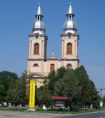 © Heinz Vogel
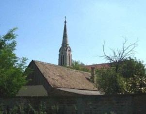 ©
©
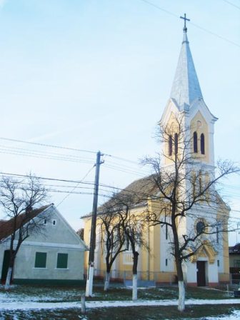 © Heinz Vogel
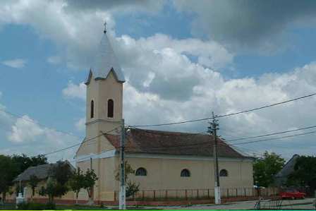 © Heinz Vogel
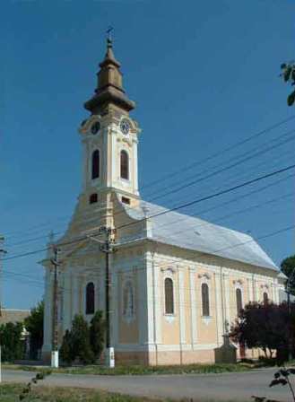 © Heinz Vogel
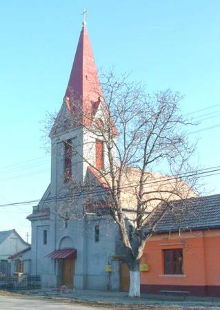 © Heinz Vogel
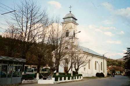 © Heinz Vogel
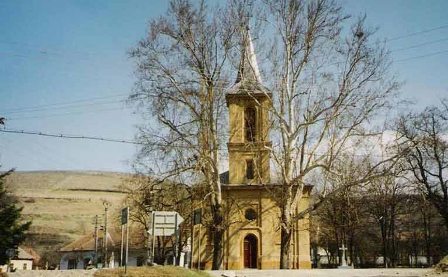 © Heinz Vogel
 © Heinz Vogel
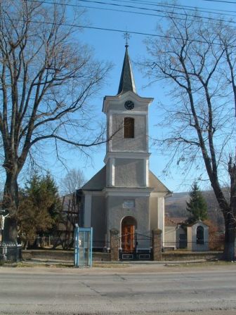 © Heinz Vogel

 © Heinz Vogel
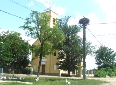 © Heinz Vogel
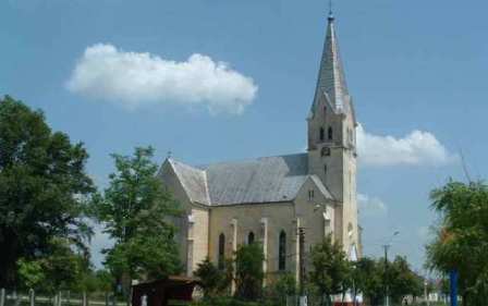 © Heinz Vogel
 ©
Sors bona
©
Sors bona


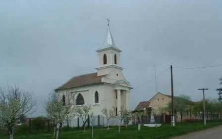 © Heinz Vogel
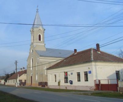 © Heinz Vogel
 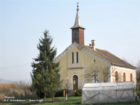 © Heinz Vogel
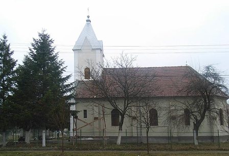 © Heinz Vogel
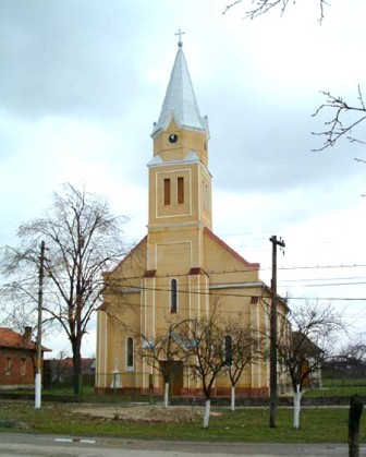 © Heinz Vogel
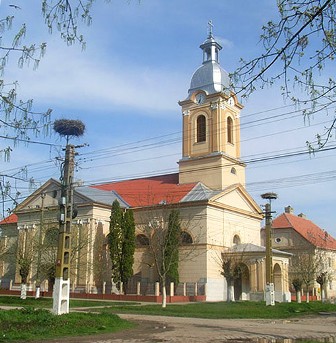 © Heinz Vogel
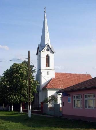 © Heinz Vogel
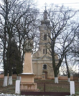 © Heinz Vogel
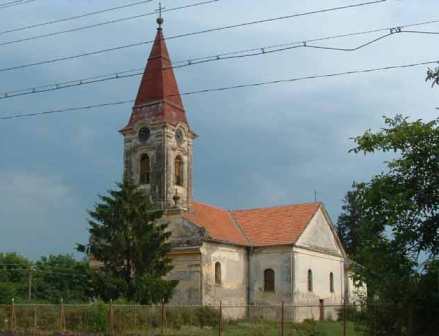 © Heinz Vogel
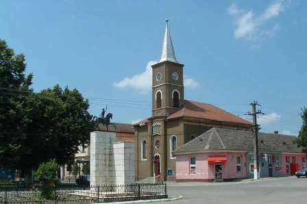

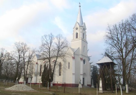


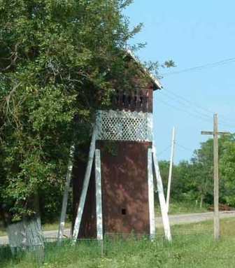
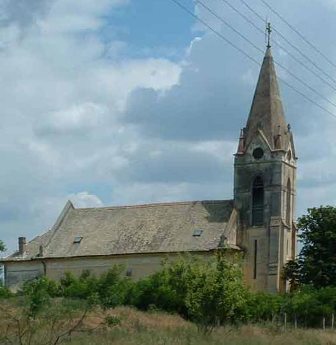
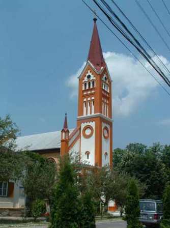
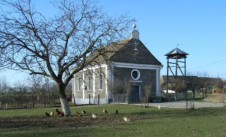
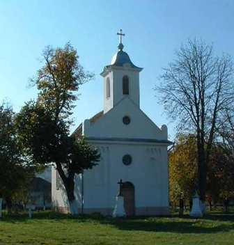

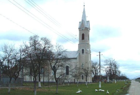
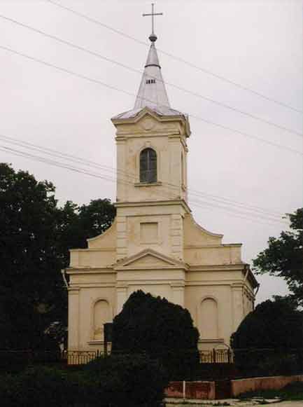
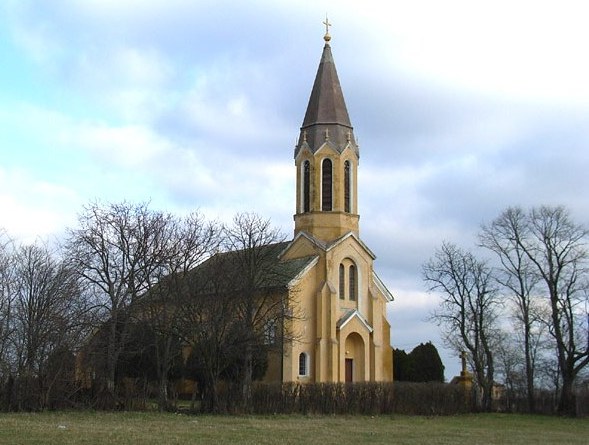

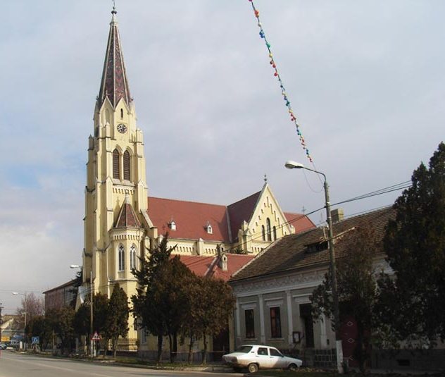

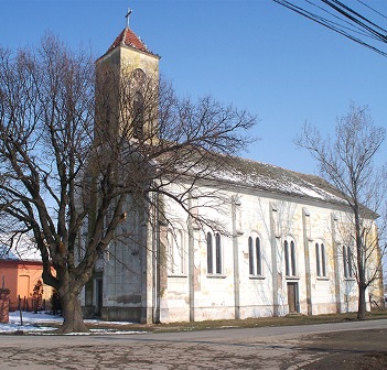
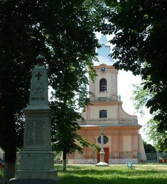
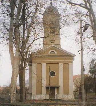
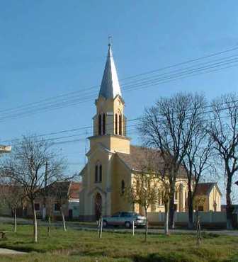
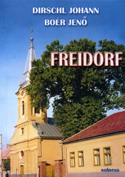


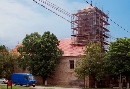
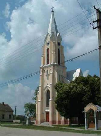
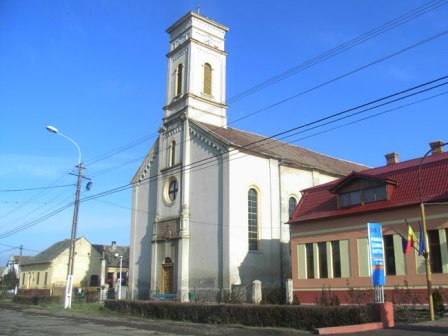
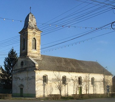
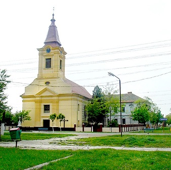
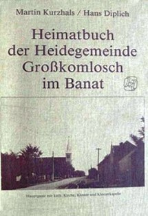

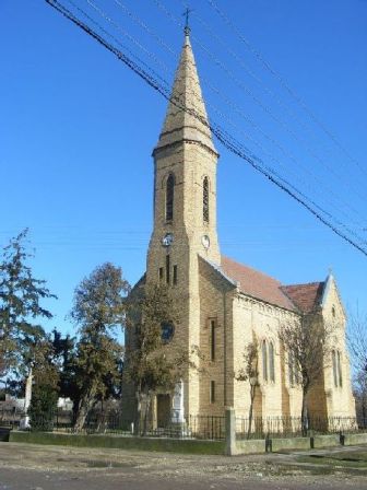


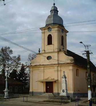


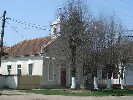

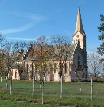
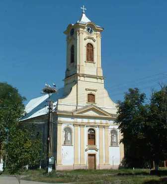
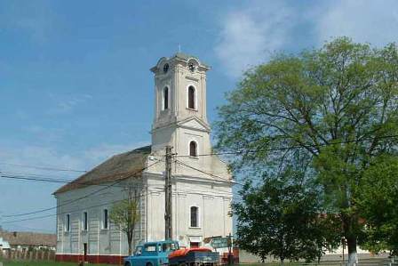
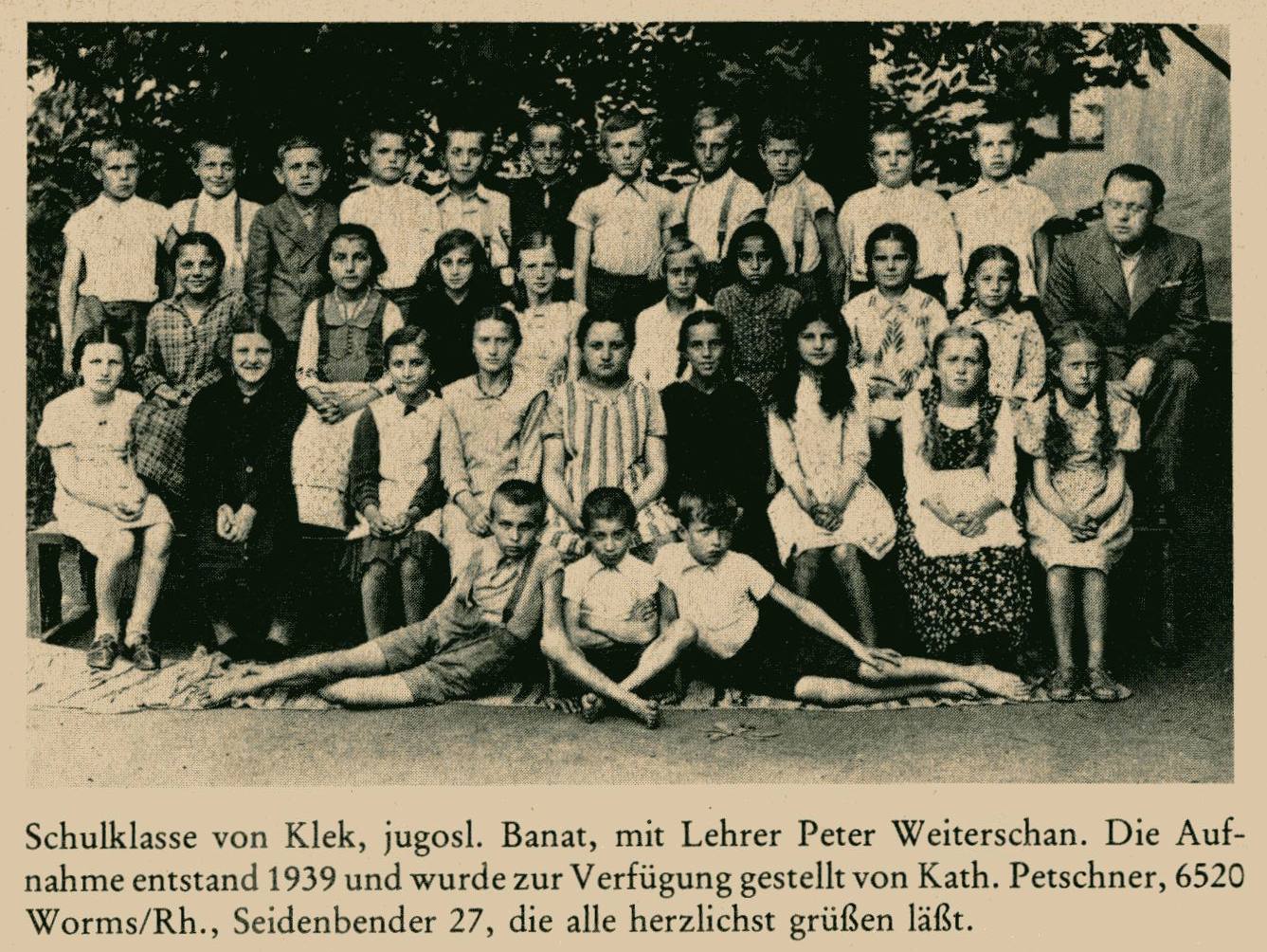
 © Heinz
Vogel
© Heinz
Vogel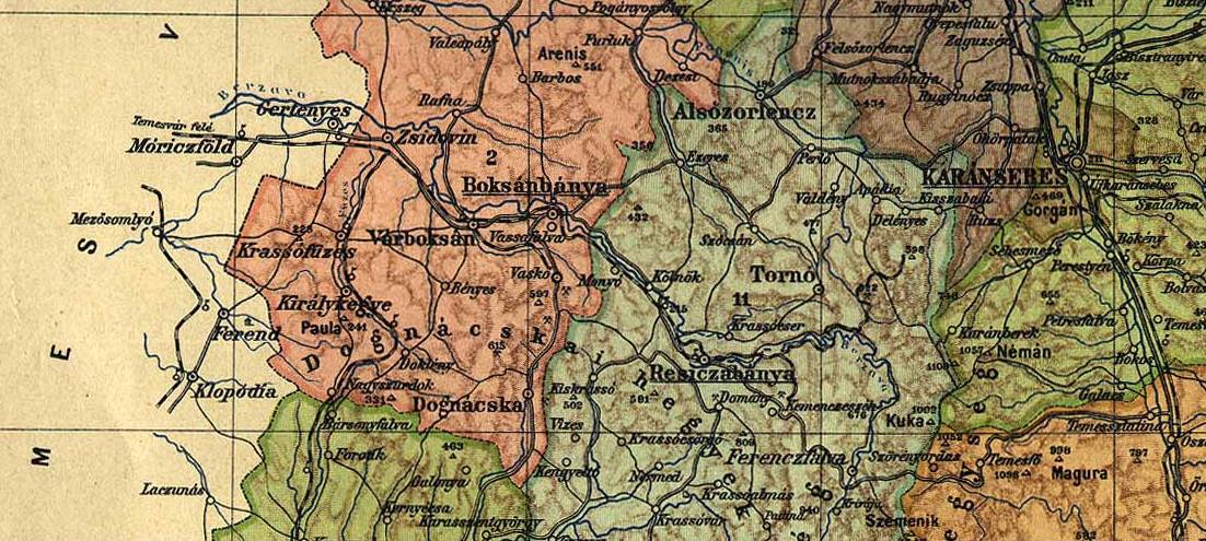
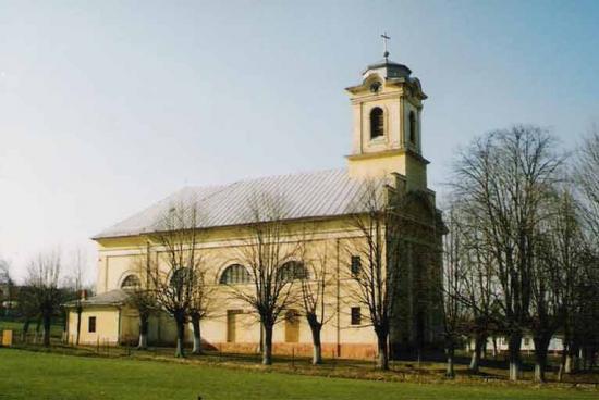
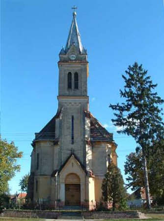
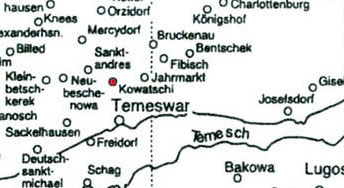
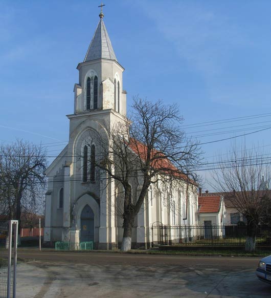
 Š Heinz Vogel
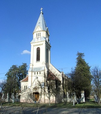
.JPG)
.jpg)

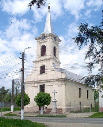 © Heinz Vogel


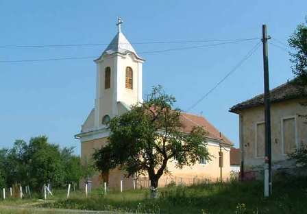
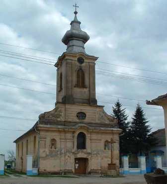
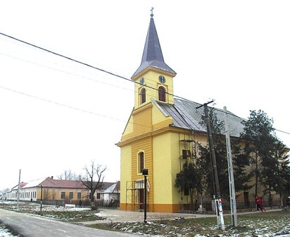
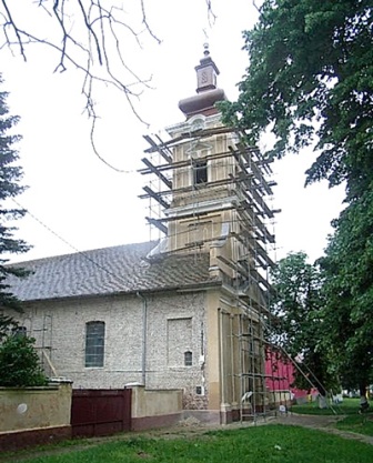
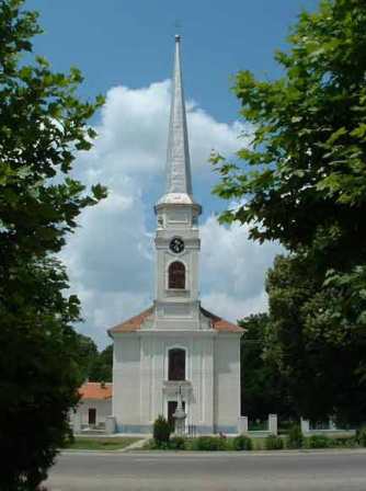


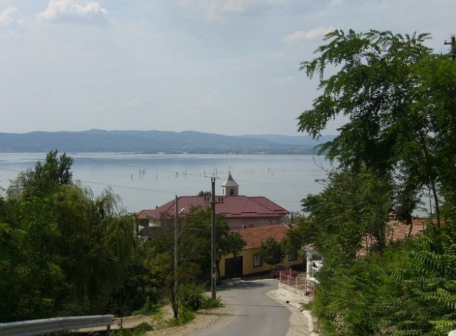


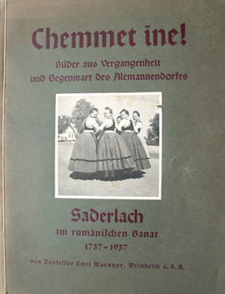


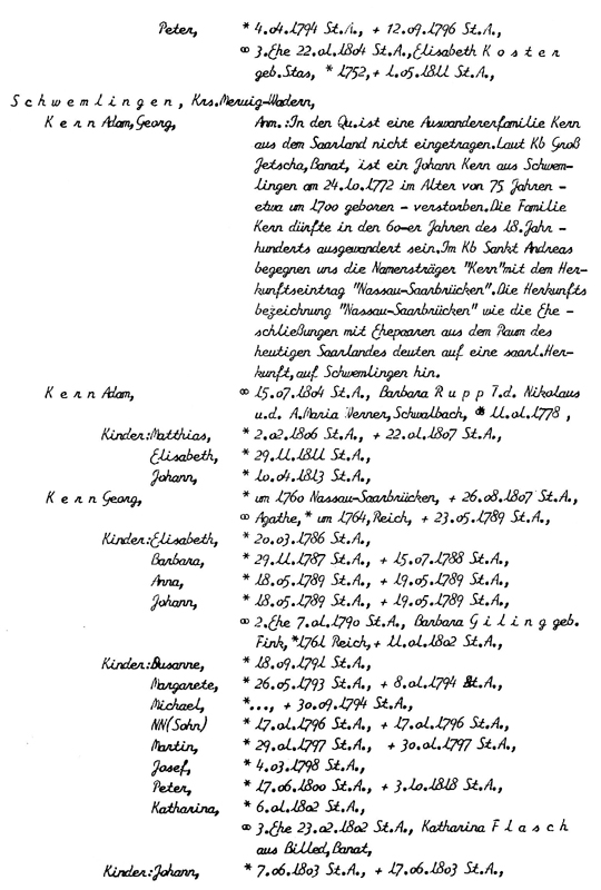
 © Heinz Vogel


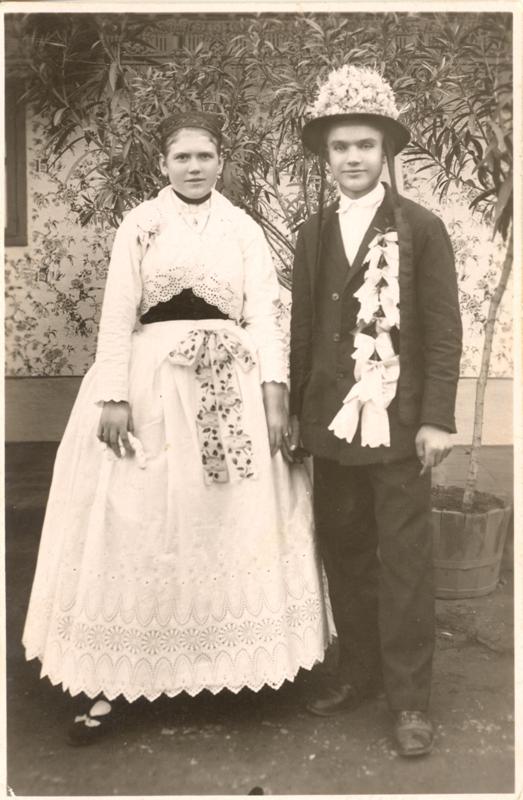
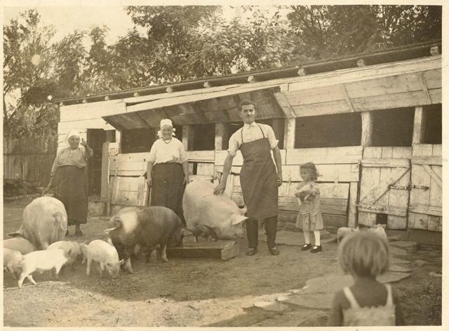


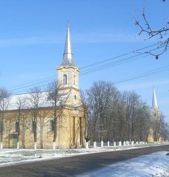
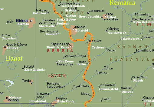
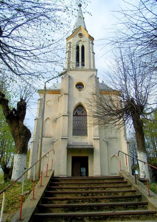

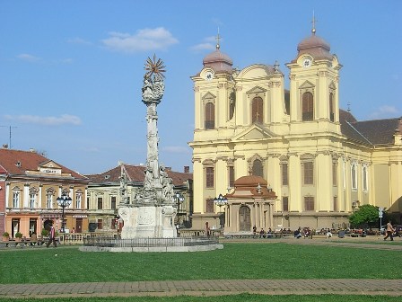
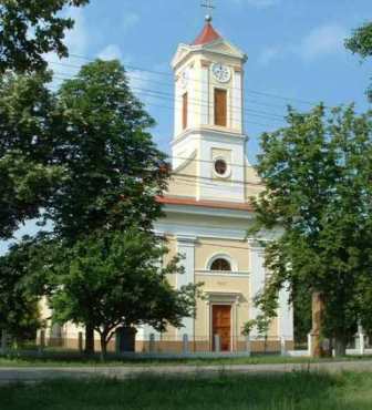

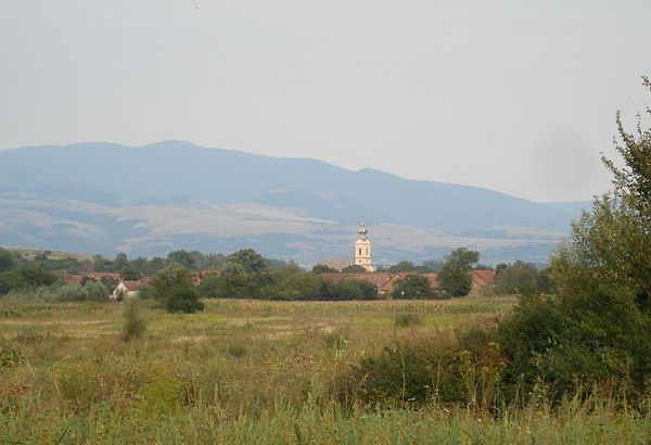
